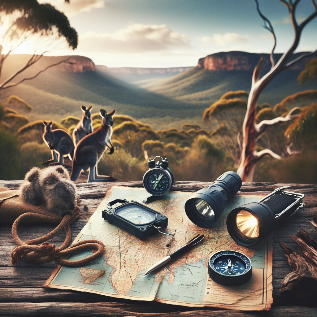
So, you’re thinking about heading into the great outdoors? Awesome! Camping is a fantastic way to reconnect with nature, challenge yourself, and just generally unwind from the stresses of modern life. But here’s the thing: while pitching a tent and roasting marshmallows are definitely part of the fun, knowing how to navigate safely is absolutely crucial. Trust me, getting lost isn’t just inconvenient; it can be downright dangerous. This guide is your starting point to becoming a confident and safe navigator in the wilderness. Let’s get started, shall we?
Why is Navigation So Important When Camping?
Ever heard that saying, “An ounce of prevention is worth a pound of cure?” Well, it definitely applies here. Think of navigation skills as your “ounce of prevention” against getting lost, injured, or worse. It’s really that simple. Out in the wild, you can’t just rely on your phone’s GPS (more on that later). Knowing how to read a map, use a compass, and understand your surroundings can be a lifesaver. Seriously. You know what else? Being able to navigate well allows you to explore further and with more confidence, enriching your overall camping experience. Who wouldn’t want that?
- Safety First: Avoiding getting lost is Priority Number 1.
- Confidence Booster: Knowing where you are and where you’re going makes the trip more enjoyable.
- Expand Your Horizons: Good navigation means you can explore more remote and beautiful locations.
Understanding the Basics: Maps, Compasses, and GPS
Okay, let’s break down the core tools of navigation. Think of a map as the big picture, the compass as your trusty direction-finder, and GPS as the tech-savvy backup. Each has its own strengths and weaknesses, and knowing how to use them together is key to staying on the right path. It’s not about choosing one over the others; it’s about integrating them into a cohesive system.
Maps: Your Bird’s Eye View
A topographic map (or “topo map”) is your detailed guide to the terrain. It shows you elevation changes, water features, vegetation, and man-made structures. Learning to read one is like learning a new language – once you get the hang of it, a whole new world opens up. And trust me, understanding those contour lines is more useful than you might think. It’s also crucial to choose the right map for the area you’ll be exploring. A map from five years ago might not show new trails or changed landmarks, so always aim for the most up-to-date version possible. Plus, always keep your map protected in waterproof case!
- Contour Lines: These lines show elevation changes. Close lines mean steep slopes, while widely spaced lines indicate gentle slopes.
- Legend: The map legend explains the symbols used on the map, such as trails, campsites, and water sources.
- Scale: The scale tells you the ratio between the distance on the map and the actual distance on the ground. For example, a scale of 1:24,000 means that 1 inch on the map equals 24,000 inches (or 2,000 feet) on the ground.
Compasses: Finding True North
A compass is your go-to tool for determining direction. It uses the Earth’s magnetic field to point you towards magnetic north. But here’s a crucial point: magnetic north isn’t the same as true north (the actual North Pole). The difference between the two is called “declination,” and you need to account for it when navigating. This deviation varies depending on your location and is often printed on topographic maps. So, always adjust your compass accordingly to avoid veering off course. And honestly, using a compass isn’t as complicated as it looks. With a little practice, you’ll be navigating like a pro.
- Baseplate Compass: This is the most common type of compass for hiking and camping.
- Declination: The difference between magnetic north and true north. Account for it!
- Sighting Mirror: Some compasses have a sighting mirror for more precise bearings.
GPS Devices: The Modern Navigator
GPS devices are incredible tools, pinpointing your location using satellites. They can store waypoints, track your route, and even provide you with digital maps. However, don’t rely on them entirely! Batteries die, signals get lost, and devices can malfunction. Always carry a map and compass as a backup. Always. Plus, get familiar with your GPS device *before* you head out. Fumbling with it in the wilderness is not the time to learn how it works. Remember, technology is great, but it’s not infallible, you know?
- Waypoints: Mark specific locations on your GPS device.
- Route Tracking: Record your path as you hike.
- Battery Life: A major concern! Always bring extra batteries or a solar charger.
Essential Navigation Skills: Map Reading, Compass Use, and GPS Basics
Now that we’ve covered the tools, let’s get into the skills. Map reading, compass use, and GPS operation are all interconnected. The better you are at each, the more confident and safer you’ll be in the backcountry. Just remember, practice makes perfect. Don’t wait until you’re in the woods to try and figure things out.
Mastering Map Reading: Understanding Topography and Symbols
We touched on this earlier, but let’s go deeper. Map reading is more than just identifying trails. It’s about understanding the terrain, planning your route, and anticipating potential hazards. Learn to visualize the landscape from the contour lines. Imagine those hills and valleys in your mind’s eye. It’s like having a superpower! Furthermore, pay attention to the symbols indicating water sources, campsites, and other key features. And honestly, a good map reader is a valuable asset to any camping group.
- Practice Identifying Terrain: Use topographic maps of your local area to practice identifying hills, valleys, and ridges.
- Plan Your Route: Use the map to estimate distances, elevation gains, and potential hazards along your chosen trail.
- Orient the Map: Align the map with your surroundings using a compass to match the map’s features with the actual landscape.
Using a Compass: Taking Bearings and Following a Course
Here’s where the compass comes into play. A bearing is the direction you want to travel, expressed in degrees. To take a bearing, point the compass in the direction you want to go, rotate the compass housing until the orienting arrow aligns with the magnetic needle, and then read the bearing at the index line. Sounds complicated? It’s not, I promise! Once you have your bearing, follow it by keeping the magnetic needle aligned with the orienting arrow as you walk. It’s like having a personal guidance system, but without the need for satellites. What’s really nice is that by mastering bearing you can cross all kinds of terrain and head to very specific locales.
- Taking a Bearing: Aim the compass, align the orienting arrow, and read the bearing.
- Following a Bearing: Keep the magnetic needle aligned with the orienting arrow as you walk.
- Back Bearings: Used to retrace your steps. Add 180 degrees to your original bearing (or subtract if the result is over 360).
GPS Essentials: Setting Waypoints and Navigating to a Destination
Okay, let’s get digital. GPS devices allow you to set waypoints (specific locations) and navigate to them with ease. Before you head out, mark important locations like your campsite, trailheads, and water sources. Then, in the field, simply select your destination and follow the device’s guidance. But remember, always keep an eye on your surroundings and double-check the GPS with your map and compass. It’s all about using the technology as a tool, not a crutch.
- Setting Waypoints: Mark important locations before your trip.
- Navigating to a Destination: Select your waypoint and follow the device’s directions.
- Understanding GPS Accuracy: GPS accuracy can vary depending on satellite availability and terrain. Be aware of potential errors.
Planning Your Route: Preparing for a Safe Trip
Proper planning is the foundation of any successful camping trip. Research your destination, study the maps, and understand the potential hazards. Consider the terrain, weather conditions, and your own physical capabilities. It’s always better to be over-prepared than under-prepared. Trust me, a little extra planning can make a *huge* difference.
Researching Your Destination: Understanding the Terrain and Weather
Knowledge is power, especially in the outdoors. Find out about the terrain you’ll be hiking through. Are there steep climbs, dense forests, or river crossings? Also, check the weather forecast and be prepared for changing conditions. Mountain weather can be unpredictable. Knowing what to expect will help you pack the right gear and make informed decisions during your trip.
- Terrain: Research the topography, vegetation, and water sources.
- Weather: Check the forecast before you go and be prepared for changes.
- Permits and Regulations: Familiarize yourself with any permits or regulations required for camping in your chosen area.
Creating a Trip Plan: Mapping Your Route and Estimating Time
A well-defined trip plan is your roadmap to success. Use your map to plot your route, mark campsites, and identify potential hazards. Estimate how long it will take you to hike each segment, taking into account elevation gains and terrain difficulty. Share your trip plan with someone you trust, along with your expected return date. This is crucial in case of an emergency. That person has to have all your maps and emergency contact info.
- Plot Your Route: Mark campsites, water sources, and potential hazards on your map.
- Estimate Time: Factor in elevation gains, terrain difficulty, and your own hiking pace.
- Share Your Plan: Leave a copy of your trip plan with someone you trust.
Packing the Right Gear: Essential Navigation Tools and Safety Equipment
Having the right gear can make all the difference in the world. In addition to your map, compass, and GPS, pack essential safety equipment like a first-aid kit, a signaling device (whistle, mirror), a repair kit, and extra food and water. And don’t forget a headlamp or flashlight! You don’t want to be caught in the dark without one. Redundancy is key here: multiple ways to start a fire, ways to signal, and ways to navigate can really help if one system fails.
- Navigation Tools: Map, compass, GPS, and a waterproof case for your map.
- Safety Equipment: First-aid kit, whistle, mirror, repair kit, extra food and water.
- Lighting: Headlamp or flashlight with extra batteries.
Staying Safe on the Trail: Navigation Tips and Emergency Procedures
Okay, you’ve planned your trip, packed your gear, and you’re ready to hit the trail. But staying safe is an ongoing process. Pay attention to your surroundings, monitor the weather, and trust your instincts. And if things do go wrong, knowing what to do can save your life. Honestly, it might.
Maintaining Situational Awareness: Observing Your Surroundings
Constantly observe your surroundings. Look for landmarks, note the direction of the sun, and pay attention to the terrain. This will help you stay oriented and avoid getting lost. Regularly check your map and compass to confirm your position. It’s easy to get tunnel vision when you’re focused on the trail, so make a conscious effort to look around.
- Landmarks: Identify distinctive features like rock formations, peaks, and bodies of water.
- Sun Position: Use the sun’s position to estimate direction (east in the morning, west in the afternoon).
- Trail Markers: Keep an eye out for trail markers and blazes.
Dealing with Unexpected Weather: Adjusting Your Route and Finding Shelter
Weather can change quickly in the mountains. Be prepared for rain, snow, wind, and extreme temperatures. If the weather turns bad, don’t hesitate to adjust your route or seek shelter. A sudden downpour can quickly turn a pleasant hike into a dangerous situation. Hypothermia is a real threat, even in relatively mild temperatures. Dress in layers, stay dry, and eat frequently to maintain your energy levels.
- Monitor the Weather: Keep an eye on the sky and be aware of changing conditions.
- Adjust Your Route: If the weather worsens, consider turning back or seeking a safer route.
- Find Shelter: Look for natural shelters like caves or dense forests, or carry a lightweight tarp for emergency shelter.
What to Do If You Get Lost: Staying Calm and Signaling for Help
Getting lost can be a terrifying experience, but panic will only make things worse. Stay calm, assess your situation, and try to retrace your steps. Use your map and compass to determine your location. If you can’t find your way back, stay put and signal for help. A whistle is an effective signaling device. Blow three short blasts, wait a few seconds, and repeat. A signal mirror can also be used to reflect sunlight towards potential rescuers. Make yourself as visible as possible.
- Stay Calm: Panic will only make things worse.
- Assess Your Situation: Try to retrace your steps and use your map and compass to determine your location.
- Signal for Help: Use a whistle, mirror, or bright clothing to attract attention.
Advanced Navigation Techniques: Taking on More Challenging Terrain
Once you’ve mastered the basics, you can start exploring more challenging terrain. This involves using advanced navigation techniques like terrain association, route finding, and navigating in low-visibility conditions. It’s all about pushing your skills to the next level and becoming a truly confident backcountry navigator. You know, it’s really rewarding.
Terrain Association: Using Natural Features to Guide You
Terrain association is the art of using natural features like ridges, valleys, and streams to guide you. Instead of relying solely on your compass bearing, you use the landscape itself as your guide. This requires a keen eye for detail and a strong understanding of topography. It’s like reading the land itself. It will keep you constantly oriented!
- Identify Key Features: Look for distinctive features that you can easily recognize on your map.
- Use Ridges and Valleys: Follow ridges and valleys as natural pathways.
- Pay Attention to Water Sources: Streams and rivers can be useful navigational aids.
Route Finding: Choosing the Best Path Through Difficult Terrain
Route finding is the process of selecting the best path through challenging terrain. This involves considering factors like elevation gain, terrain difficulty, and potential hazards. Sometimes the most direct route isn’t always the best route, especially when dealing with steep slopes or dense vegetation. It’s better to make a more roundabout route.
- Assess the Terrain: Evaluate the difficulty and potential hazards of different routes.
- Consider Elevation Gain: Choose a route that minimizes steep climbs when possible.
- Avoid Hazards: Steer clear of dangerous areas like cliffs, unstable slopes, and avalanche zones.
Navigating in Low Visibility: Using a Compass and Pacing
Navigating in fog, snow, or heavy rain can be extremely challenging. Visibility is limited, and landmarks can disappear. In these conditions, a compass and pacing are essential. Use your compass to maintain your bearing and pace count to estimate distance. This requires meticulous attention to detail and a high level of concentration. Its a real skill builder, you know?
- Compass Bearings: Rely heavily on your compass to maintain your direction.
- Pace Counting: Count the number of steps it takes you to travel a known distance and use this to estimate your distance traveled.
- Careful Observation: Pay close attention to any visible features, even if they are only visible for a short time.
Frequently Asked Questions (FAQs)
Got questions? We’ve got answers! Here are some commonly asked questions about camping navigation to help you feel more prepared.
DISCLAIMER
This beginner’s guide to camping navigation is intended for informational purposes only and should not be considered a substitute for professional training or guidance. Camping and outdoor activities involve inherent risks, and it is the responsibility of the individual to assess their own skills, knowledge, and physical condition before participating in such activities. Always prioritize safety, follow established guidelines, and be aware of potential hazards. The author and publisher assume no liability for any injuries, damages, or losses incurred as a result of using the information provided in this guide.
Categories
- Navigation & Safety (68)
- Shelter & Sleep (72)
Top rated products
-
 Ultimate AONIJIE Soft Flask 1000 ml/2000 ml with Water Filter Rated 5.00 out of 5
$38.70Original price was: $38.70.$26.97Current price is: $26.97. -
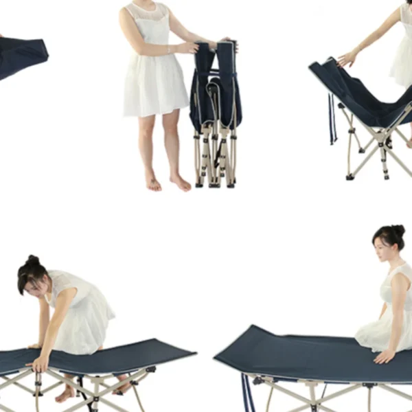
Portable Folding Bed for Office Naps & Outdoor Adventures Rated 5.00 out of 5$168.06 – $305.16Price range: $168.06 through $305.16
-
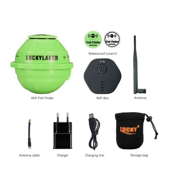
Revolutionize Your Fishing with Lucky Smart Wi-Fi Fish Finder Rated 5.00 out of 5
$197.75Original price was: $197.75.$137.82Current price is: $137.82.

Product Gallery
-
 Ultimate 2-3 Person Inflatable Kayak for Fishing Fun Rated 5.00 out of 5$1,092.43 – $1,105.95Price range: $1,092.43 through $1,105.95
 -
VEVOR 550 lb Heavy-Duty Folding Wagon & Bench for Adventurers
$155.14 – $252.20Price range: $155.14 through $252.20
-
BISINNA One-Touch Titanium Tent for 3-4 Campers, Adventure Ready Rated 4.36 out of 5
$311.78Original price was: $311.78.$217.30Current price is: $217.30.


 Camping Gear
 Camping Chair
 Camping Table
 Camping Bed
 Sleeping Gear
 Storage Bags
 BBQ Portable
 Sleeping Bags
 Camping Tents
 Gazebos
 Outdoor Cooler
 Cookware
 Power
Power Camping Light
 Flashlight
 Portable Solar
 Power Banks
 Fish Finders
 Fishing Bags
 Fishing Jerseys
 Fishing Reels
 Fishing Chairs
 Fishing Bait Boat
 Fishing Floats
 Hard Baits
 Hiking Vests
 Outdoor Bags
 Water Filters
 Paracord
 Walkie Talkie
 Paddleboards
 Boats
Boats Sea Scooter
 Accessories
 Electric Bike
 Electric Scooter
Recent Comments