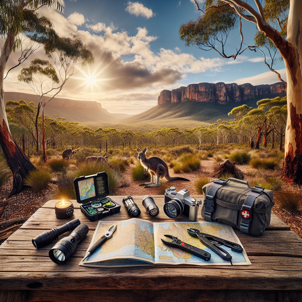
So, you’re itching to explore the backcountry, but the thought of dropping serious cash on fancy GPS gadgets makes your wallet weep? I get it. You don’t need to break the bank to find your way in the wilderness. Honestly, some of the most reliable navigation methods are surprisingly affordable—or even free! This guide will cover the essentials of budget-friendly camping navigation, so you can confidently hit the trails without emptying your bank account.
Why Bother with Navigation Skills? Isn’t There an App for That?
Okay, let’s be real. We live in a digital age, and yes, there are countless apps that promise to guide you through the wilderness. And I’m not knocking those. They can be extremely useful. But relying solely on your phone is a gamble. Batteries die, screens crack, and signal vanishes faster than free pizza at a tech conference. Plus, knowing how to navigate with a map and compass connects you to the landscape in a way that staring at a screen just can’t. It’s about self-reliance, about respecting the environment, and frankly, about being prepared for when—not if—technology fails. Besides, there’s a certain satisfaction that comes from plotting a course the old-fashioned way, don’t you think?
The Foundation: Maps and Compasses – Your Best (and Cheapest) Friends
Alright, let’s talk about the true bread and butter of budget navigation: the map and compass. Forget about needing a trust fund to get good at this! Seriously, these tools are reliable, time-tested, and require zero batteries. Plus, learning to use them is actually kind of fun, like solving a puzzle out in nature.
Understanding Topographic Maps: Reading the Land
Topographic maps—or “topo” maps—are your window into the terrain. They use contour lines to represent elevation changes, which means you can visualize hills, valleys, ridges, and other features. Understanding how to read these maps is crucial for planning your route and avoiding unexpected surprises (like a vertical cliff you didn’t see coming). Think of them as a cheat sheet to the Earth’s secret code.
Here’s what you need to know:
- Contour Lines: These lines connect points of equal elevation. The closer the lines, the steeper the slope. Widely spaced lines indicate a gentle slope or flat area.
- Elevation: Topo maps will show you the elevation of specific points, like mountain summits or lake surfaces.
- Symbols: Maps use symbols to represent features like trails, roads, buildings, rivers, and vegetation. A map legend will explain what each symbol means.
- Scale: The map scale tells you the relationship between distances on the map and distances on the ground. For example, a scale of 1:24,000 means that one inch on the map equals 24,000 inches (or 2,000 feet) on the ground.
Getting comfortable with topo maps takes practice. Start by studying maps of areas you know well. Compare the map to the actual landscape. See how the contour lines represent the hills and valleys you can see with your own eyes. The more you practice, the easier it will become to visualize the terrain from the map. Trust me, it’s like learning a new language—once you get the basics, you’ll be fluent in “map speak” in no time.
Compass Basics: Finding Your Direction
A compass is your trusty guide to direction. It uses the Earth’s magnetic field to point you towards magnetic north. While there are fancy compasses out there with all sorts of bells and whistles, a basic baseplate compass is all you need to get started. These things are affordable, durable, and easy to use. Don’t overthink it; just get a solid one and learn to use it well. So, why do you need a compass?
- Orientation: A compass helps you orient your map, aligning it with the real-world terrain.
- Bearing: You can use a compass to take a bearing, which is the angle between your current location and your destination.
- Navigation: By following a bearing, you can navigate in a straight line, even when you can’t see your destination.
Now, a little jargon. You’ll encounter terms like declination. What is it? Declination is the difference between magnetic north (where your compass points) and true north (the geographic North Pole). Maps are generally oriented to true north, so you’ll need to adjust your compass reading to account for declination. The amount of declination varies depending on your location. You can find the declination for your area on most topographic maps, or online. This is critical since ignoring declination can throw off you navigation significantly, potentially leading you off course by a considerable distance. Just something to keep in mind!
Essential Map and Compass Skills: Level Up Your Navigation Game
Having the tools is one thing, knowing how to use them is another. Let’s look at some crucial skills to master.
Orienting Your Map: Aligning with Reality
Orienting your map means aligning it with the terrain around you. This allows you to match features on the map (like hills, rivers, and trails) with the corresponding features in the real world. Here’s how you do it:
- Place your compass on the map.
- Rotate the map until the north end of the compass needle points to north on the map.
- Now, the features on your map should be aligned with the features in the landscape.
Once your map is oriented, you can easily identify your location, plan your route, and anticipate upcoming terrain changes. It’s like having a miniature version of the landscape right in your hands.
Taking a Bearing: Setting Your Course
Taking a bearing involves determining the compass direction you need to travel to reach your destination. It’s like setting a course for your adventure, ensuring you’re headed the right way. This is especially useful when you can’t see your destination directly.
- Locate your current position and your destination on the map.
- Place the edge of your compass baseplate along the line connecting your current location and your destination.
- Rotate the compass housing until the orienting lines on the compass are aligned with the north lines on the map. Make sure the north end of the orienting arrow points to north on the map.
- Read the bearing (in degrees) at the index line or bezel on the compass housing.
- Adjust your bearing for declination.
- Remove the compass from the map. Hold the compass in front of you and rotate your body until the north end of the compass needle aligns with the orienting arrow on the compass housing.
- Choose a landmark in the distance that lies along your bearing. Walk towards that landmark.
- Repeat as needed.
Taking a bearing might seem complex at first, but with practice, it becomes second nature. Think of it as setting a GPS coordinate without the need for a satellite. You’re using the Earth’s magnetic field and a little bit of map reading to guide you.
Triangulation: Finding Your Location When You’re Lost (Uh Oh!)
Okay, so you’ve wandered off the trail and you’re not quite sure where you are. Don’t panic! Triangulation can help you pinpoint your location using bearings to known landmarks. It’s like being a detective in the wilderness, piecing together clues to solve the mystery of your whereabouts.
- Identify two or three prominent landmarks that you can also locate on your map (e.g., mountain peaks, distinctive rock formations, or trail junctions).
- Take a bearing to each landmark.
- Convert the magnetic bearings to true bearings by adding or subtracting the declination.
- Find the landmarks on the map. Use a protractor and ruler to draw a line along the back bearing (reciprocal bearing, or reverse bearing) from each landmark. This is made by subtracting or adding 180 degrees from your true bearing. Do the same procedure for at least one more landmark. The intersection of these lines is your approximate location.
Triangulation is a valuable skill that can save you from getting seriously lost. But remember, it’s always best to prevent getting lost in the first place by paying attention to your surroundings, regularly checking your map and compass, and staying on marked trails. That said, if you do find yourself disoriented, triangulation is your friend.
Budget-Friendly Gear: What You Need (and What You Don’t)
Navigating on a budget doesn’t mean skimping on quality. It means being smart about your purchases and prioritizing essential gear. Here’s a breakdown of what you need and what you can skip (at least to start).
- Essential: A Reliable Baseplate Compass: You can find a decent one for under $30. Brands like Suunto and Silva offer reliable options.
- Essential: Topographic Maps: You can purchase individual maps for specific areas for a few dollars each. Check local outdoor stores or online retailers. Honestly, sometimes you can even find them used!
- Essential: A Waterproof Map Case: Protect your map from rain and tears. These are inexpensive and worth their weight in gold.
- Optional (But Recommended): A Compass Clinometer: This tool can help you measure the angle of slopes, which can be useful for assessing avalanche risk or planning a route through steep terrain. It’s not essential for beginners, but it’s a nice tool to have as you advance your navigation skills.
- Skip (For Now): Fancy GPS Devices: While GPS devices can be helpful, they’re not necessary for basic navigation. Focus on mastering map and compass skills first. You can always add a GPS later if you feel you need it.
Remember, the most important piece of gear is your brain. Spend time learning and practicing your navigation skills. No amount of fancy equipment can replace a solid understanding of map and compass techniques.
Practice Makes Perfect: Honing Your Skills Before Hitting the Trail
Navigation is a skill that requires practice. Don’t wait until you’re lost in the wilderness to try and figure out how to use a map and compass. Start practicing in familiar environments, like your local park or neighborhood. The more you practice, the more confident you’ll become.
Here are some ideas for practicing your navigation skills:
- Orienteering Courses: Orienteering is a sport that combines navigation with running or hiking. Many parks and outdoor clubs offer orienteering courses that are a great way to practice your map and compass skills in a fun and challenging environment.
- Geocaching: Geocaching is a treasure-hunting game that uses GPS coordinates. While it relies on GPS, it can still be a fun way to practice your navigation skills and explore new areas.
- “Urban Orienteering”: Practice navigating in your city using a map and compass. Plan a route that takes you to specific landmarks, and use your navigation skills to find your way.
Don’t be afraid to make mistakes. Getting lost is part of the learning process. The important thing is to learn from your mistakes and keep practicing. With time and experience, you’ll become a skilled navigator, capable of confidently exploring the backcountry.
Staying Safe: Navigation and Risk Management
Navigation is just one piece of the puzzle when it comes to staying safe in the backcountry. It’s also important to consider other factors, such as weather conditions, terrain hazards, and your own physical and mental limitations. Before heading out on a trip, take the time to assess the risks and plan accordingly. Honestly, it’s better to be over-prepared than under-prepared. Especially when your safety is at stake.
Here are some tips for staying safe while navigating in the backcountry:
- Check the Weather Forecast: Weather conditions can change rapidly in the mountains. Be sure to check the forecast before you go, and be prepared for unexpected changes.
- Tell Someone Your Plans: Let someone know where you’re going, when you expect to be back, and who to contact if you don’t return on time.
- Carry a First-Aid Kit: Be prepared to treat minor injuries and illnesses.
- Bring Plenty of Food and Water: You’ll need energy to navigate and stay warm.
- Dress in Layers: Be prepared for changing temperatures and conditions.
- Know Your Limits: Don’t push yourself beyond your physical and mental capabilities.
Remember, the backcountry is a beautiful but potentially dangerous place. By taking the time to learn navigation skills and manage risks, you can enjoy your adventures safely and responsibly.
Beyond the Basics: Resources for Continued Learning
Okay, you’ve got the basics down. But navigation is a lifelong learning process. There’s always more to learn, new techniques to master, and different environments to explore. Here are some resources to help you continue your navigation education:
- Mountaineering and Outdoor Skills Books: The Mountaineers Books publishes a range of excellent books on navigation and other outdoor skills. Check out “Mountaineering: The Freedom of the Hills” for a comprehensive guide to all things mountaineering, including navigation.
- Online Resources: Websites like REI and Backpacker Magazine offer articles, videos, and tutorials on navigation and other outdoor topics.
- Outdoor Skills Courses: Many outdoor organizations and guide services offer courses on navigation, wilderness survival, and other essential skills.
- Local Hiking Clubs: Joining a local hiking club is a great way to meet other outdoor enthusiasts, learn from experienced hikers, and explore new trails.
And don’t forget the most valuable resource of all: experience. The more time you spend in the outdoors, the more you’ll learn about navigation, risk management, and the subtle cues of the natural world.
So, get out there, explore, and keep learning! The wilderness is waiting.
Before I forget: Don’t underestimate the value of good old-fashioned common sense! Trust your instincts, pay attention to your surroundings, and don’t be afraid to turn back if something doesn’t feel right. The mountains will always be there; your well-being is paramount.
Time to Get Started!
Navigating the wilderness on a budget is totally achievable! By mastering the basics of map and compass navigation, investing in a few key pieces of gear, and practicing your skills regularly, you can confidently explore the backcountry without breaking the bank. So get out there, embrace the adventure, and discover the joy of navigating the natural world. Happy trails!
Frequently Asked Questions (FAQ)
Always orient your map to your surroundings! Matching the map to the real world is crucial for accurate navigation.
Declination is the difference between magnetic north (where your compass points) and true north (what maps use). Find the declination for your area, and either add or subtract it from your compass bearing depending on whether declination is East or West.
Stay calm! Use triangulation to try and pinpoint your location, and if possible, retrace your steps to a known point. If you can’t find your way, stay put, build a shelter, and wait for help. Remember to tell someone your plans before you go!
I wouldn’t recommend it. Phones can fail due to battery life, damage, or lack of signal. Always carry a map and compass as a backup, and know how to use them.
A basic baseplate compass from a reputable brand like Suunto or Silva is perfect for beginners. Look for one with a liquid-filled capsule, a rotating bezel, and a declination adjustment.
You can purchase topographic maps from outdoor retailers, online stores, or government agencies like the USGS (United States Geological Survey). You can also find digital topo maps online, but it’s always a good idea to carry a paper map as a backup.
As often as possible! Even a few minutes of practice each week can make a big difference. The more you practice, the more confident and proficient you’ll become.
DISCLAIMER
The information provided in this article is for general guidance only and does not constitute professional advice. Backcountry navigation involves inherent risks, and it is the responsibility of each individual to assess their own skills, experience, and the specific conditions of their planned trip. Always consult with experienced guides or instructors before attempting any challenging navigation or wilderness travel. The author and publisher are not responsible for any accidents, injuries, or losses that may occur as a result of using the information in this article.
Categories
- Navigation & Safety (68)
- Shelter & Sleep (72)
Top rated products
-
 Ultimate AONIJIE Soft Flask 1000 ml/2000 ml with Water Filter Rated 5.00 out of 5
$41.58Original price was: $41.58.$28.98Current price is: $28.98. -
Portable Folding Bed for Office Naps & Outdoor Adventures Rated 5.00 out of 5$168.06 – $305.16Price range: $168.06 through $305.16
-
Revolutionize Your Fishing with Lucky Smart Wi-Fi Fish Finder Rated 5.00 out of 5
$197.75Original price was: $197.75.$137.82Current price is: $137.82.


Product Gallery
-
 Ultimate 2-3 Person Inflatable Kayak for Fishing Fun Rated 5.00 out of 5$1,081.72 – $1,095.09Price range: $1,081.72 through $1,095.09
 -
VEVOR 550 lb Heavy-Duty Folding Wagon & Bench for Adventurers
$155.14 – $252.20Price range: $155.14 through $252.20
-
BISINNA One-Touch Titanium Tent for 3-4 Campers, Adventure Ready Rated 4.36 out of 5
$311.78Original price was: $311.78.$217.30Current price is: $217.30.


 Camping Gear
 Camping Chair
 Camping Table
 Camping Bed
 Sleeping Gear
 Storage Bags
 BBQ Portable
 Sleeping Bags
 Camping Tents
 Gazebos
 Outdoor Cooler
 Cookware
 Power
Power Camping Light
 Flashlight
 Portable Solar
 Power Banks
 Fish Finders
 Fishing Bags
 Fishing Jerseys
 Fishing Reels
 Fishing Chairs
 Fishing Bait Boat
 Fishing Floats
 Hard Baits
 Hiking Vests
 Outdoor Bags
 Water Filters
 Paracord
 Walkie Talkie
 Paddleboards
 Boats
Boats Sea Scooter
 Accessories
 Electric Bike
 Electric Scooter
Recent Comments