
Stay Safe in the Wilderness: A Camper’s Guide to Map and Compass Skills
Getting lost in the woods? Not exactly anyone’s idea of a good time. That’s why mastering map and compass skills isn’t just a cool party trick—it’s essential for every camper and hiker. Think of it as your navigational lifeline, especially when your phone decides to take an unexpected vacation from reality, leaving you without GPS.
Why Map and Compass? Ditching the Digital Crutch
So, why bother learning about maps and compasses when we have smartphones and fancy GPS gadgets? Well, technology is awesome—until it isn’t. Batteries die, screens crack, and satellite signals can be as reliable as a politician’s promise. Plus, there’s something deeply satisfying about navigating using skills that have guided explorers for centuries. It connects you to the land in a way a screen never could.
And here’s a thought: relying solely on tech can make you complacent. What happens when the unexpected occurs? Being able to read a map and use a compass provides a backup, sure, but also a deeper understanding of your surroundings.
Understanding Topographic Maps: More Than Just Lines on Paper
Let’s get into the nitty-gritty. A topographic map isn’t your average road map. It’s a detailed representation of the Earth’s surface, showing elevation changes (that’s where those squiggly contour lines come in), natural features like rivers and forests, and man-made structures like roads and buildings. They’re like blueprints for the land itself.
Key Map Features: Decoding the Landscape
Think of a map as having its own secret language. Once you learn the key features, you’ll be fluent in “land.” Here’s your phrasebook:
- Contour Lines: These are the squiggly lifelines of a topo map. They connect points of equal elevation. The closer the lines, the steeper the terrain. Far apart? Gentle slope. When they form concentric circles, that indicates a hill or mountain.
- Legend: Your map’s decoder. It tells you what all those symbols mean—what’s a road, what’s a trail, what’s a ranger station, you name it.
- Scale: This tells you the relationship between distances on the map and the actual distances on the ground. A scale of 1:24,000 means one inch on the map equals 24,000 inches (or 2,000 feet) in the real world.
- North Arrow: Crucial for orientation. It shows you the direction of true north, magnetic north, and sometimes grid north. More on that magnetic declination stuff later.
Understanding these features is like learning the grammar of the landscape. It allows you to not only read the map but also interpret what it’s telling you about the terrain ahead. What obstacles might be there, what the elevation looks like, where there are points of interest.
The Compass: Finding Your Way When Lost Feels Like a Given
The compass is your trusty sidekick. It’s a simple tool, but when used correctly, it’s unbelievably powerful. It doesn’t rely on batteries or satellite signals, just good old-fashioned magnetism.
Anatomy of a Compass: Meet Your Magnetic Friend
Let’s break down what makes a compass tick (or rather, point north):
- Magnetic Needle: This is the heart of the compass. It’s a magnetized piece of metal that aligns itself with the Earth’s magnetic field, pointing towards magnetic north.
- Baseplate: The clear plastic base that holds everything together. It has a ruler on the side for measuring distances on the map.
- Rotating Bezel (or Azimuth Ring): The rotating ring around the compass housing, marked with degrees from 0 to 359. You’ll use this to set and follow bearings.
- Direction-of-Travel Arrow (or Index Line): The arrow on the baseplate that shows you which way to go once you’ve set your bearing.
- Orienting Arrow: The arrow inside the compass housing that you align with the magnetic needle when taking a bearing from a map.
Knowing how all these parts work together is essential for accurate navigation. It’s like knowing the parts of an engine–you don’t have to be a mechanic to drive, but it sure helps when something goes wrong!
Putting It All Together: Map and Compass in Action
Alright, let’s get practical. Reading a map and understanding a compass are great, but the real magic happens when you use them together.
Orienting Your Map: Getting Your Bearings
The first step is orienting your map, meaning aligning it with the real world. Here’s how:
- Lay the map flat: Find a relatively level surface.
- Place the compass on the map: Put the compass on the map.
- Rotate the map: Turn the map and compass together until the north end of the compass needle points to the north on the map. Imagine they’re having a conversation, the red needle and ‘N’ on the map.
Now, the features on the map should roughly align with the features in the landscape around you. Roads should run in the directions you see them and mountain peaks should be where you expect them to be.
Taking a Bearing From the Map: Plotting Your Course
A bearing is the direction you need to travel to reach a specific point. Here’s how to take one from the map:
- Identify your location and destination on the map: Pinpoint where you are and where you want to go.
- Place the edge of the compass baseplate along your desired route: Align the edge of the baseplate between your current location and your destination.
- Rotate the bezel: Turn the rotating bezel until the orienting arrow aligns with the north end of the compass (usually marked in red).
- Account for Declination: This is important! Declination is the angle between true north and magnetic north. You’ll need to add or subtract the declination angle (specific to your location) from your compass bearing. Maps typically show you what the declination is for that particular location.
Here’s a simple trick to remember which way to add or substract: “East is least (subtract), West is best (add)” This refers to how you should adjust when your declination is East or West.
Following a Bearing in the Field: Staying on Track
Now that you have your bearing, it’s time to put it to use in the real world:
- Hold the compass level in front of you: Make sure the direction-of-travel arrow is pointing away from you.
- Rotate your body: Turn your body until the north end of the magnetic needle aligns with the orienting arrow inside the compass housing. Forget the map for now, just match the needle to the correct position.
- Follow the direction-of-travel arrow: Pick a landmark in the distance that is in line with your direction-of-travel arrow, and walk towards it. This is called “aiming off” and essentially you follow your landmark, check, re-aim, follow, check.
- Repeat as needed: Keep checking your compass to make sure you’re staying on course. Terrain can change, and it’s easy to veer off course without realizing it.
Following a bearing isn’t about staring at your compass the whole time. It’s about picking a point in the distance, hiking to it, and then re-checking your bearing to make sure you’re still on track. Think of it as a series of mini-goals.
Dealing with Declination: The Magnetic North Reality Check
Declination is the difference between true north (the North Pole) and magnetic north (where your compass needle points). It varies depending on your location and changes over time. Ignoring declination can throw your navigation off by several degrees, which can translate to significant distances in the field.
Every year, the movement of the magnetic north pole changes slightly which affects your compass reading.
Finding the Declination for Your Area: Knowledge is Power
You can find the declination for your area on most topographic maps. It’s usually printed in the map’s margin. You can also use online resources, such as the National Oceanic and Atmospheric Administration (NOAA) website to find the current declination for your specific coordinates.
Adjusting Your Compass: Setting It and Forgetting It (Almost)
Some compasses allow you to adjust for declination. If yours does, great! Set it once for your area, and you won’t have to worry about adding or subtracting the declination angle every time you take a bearing. If your compass doesn’t have this feature, you’ll need to manually adjust your bearings.
Advanced Techniques: Level Up Your Navigation Game
Once you’ve mastered the basics, you can start exploring more advanced techniques.
Resection: Finding Your Location When You’re Lost
Resection is a technique for determining your current location by taking bearings to two or more known landmarks. It’s like triangulation, but for navigation. Here’s the gist:
- Identify two or three landmarks you can see and locate on the map: Think mountain peaks, distinctive rock formations, or buildings.
- Take a bearing to each landmark: Use your compass to measure the bearing to each landmark.
- Convert the bearings to back bearings: A back bearing is the reverse of a bearing. To find it, add 180 degrees to your original bearing if it’s less than 180 degrees, or subtract 180 degrees if it’s greater than 180 degrees.
- Plot the back bearings on the map: Use a protractor or the compass itself to draw lines along the back bearings from each landmark on the map.
- Where the lines intersect is your approximate location: The more accurate your bearings, the more precise your location will be.
Resection is a lifesaver when you’re not sure where you are on the map. I once had to use this after I took a wrong turn off a trail, and got completely disoriented.
Using Terrain Association: Reading the Land Like a Book
Terrain association involves using the features of the landscape to confirm your location and direction. It’s about paying attention to your surroundings. Does the stream flow to the east, as the map suggests? Is that distinctive rock formation on your left, as it should be? Are you following a ridgeline?
Terrain association is a skill that develops over time with experience. The more you practice, the better you’ll become at reading the land and using it to your advantage.
Staying Found: Prevention and Best Practices
The best way to use a map and compass? Don’t get lost in the first place. Prevention is the best medicine, especially in the wilderness.
Planning Your Route: Do Your Homework
Before you head out, study your map and plan your route. Identify key landmarks, potential hazards, and alternative routes. Let someone know your plans. What time you plan on leaving, what route you are taking, and when you expect to be back.
Regularly Check Your Location: Are We There Yet?
Don’t wait until you’re lost to check your location. Regularly compare the map to the terrain around you. It only takes a few seconds to get a sense of where you are. And be aware of your surroundings, noting any changes as you go.
Trust Your Compass: Even When You Think You Know Better
Your instincts can be wrong. Your compass usually isn’t. Even if the terrain doesn’t look like it matches the map, trust your compass and keep following your bearing. There may be a reason for the discrepancy that you can’t see at the moment.
I know this sounds obvious, but it’s easy to let your assumptions and wishful thinking override what the compass is telling you.
Essential Gear: Setting Yourself Up for Success
Having the right tools can dramatically improve your experience and safety in the wilderness. Here’s a list of essential gear you should consider having:
- Quality Compass: Invest in a durable baseplate compass with adjustable declination.
- Topographic Maps: Carry detailed topographic maps of the area you’ll be exploring. Consider waterproof maps or a waterproof map case.
- Whistle: An essential safety item for signaling distress.
- Headlamp or Flashlight: Crucial for navigating in low-light conditions or unplanned overnight stays.
- First-Aid Kit: Include items for treating common injuries and illnesses.
- Multi-Tool or Knife: Useful for various tasks, from cutting rope to repairing gear.
- Navigation Apps: These can supplement your paper maps and compass, but make sure to download offline maps in advance.
When it comes to safety in the wilderness, it’s better to have it and not need it, than to need it and not have it.
Practice, Practice, Practice: From Backyard to Backcountry
Map and compass skills are like any other skill—they require practice. Don’t wait until you’re lost in the wilderness to try them out. Start in your backyard, local park, or familiar hiking trails.
Start Simple: Backyard Orienteering
Create a simple orienteering course in your backyard or local park. Use landmarks like trees and fences as your checkpoints. Time yourself and see if you can improve your time with practice.
Progress to More Challenging Terrain: Trail Time
Once you’re comfortable with the basics, take your skills to more challenging terrain. Practice navigating on established hiking trails, and then gradually venture off-trail. Always let someone know your plans and carry a map and compass, even on familiar trails.
Remember, the goal is to develop muscle memory and confidence. The more you practice, the more natural these skills will become.
Mastering map and compass skills is more than just a way to avoid getting lost. It’s a way to connect with the land, challenge yourself, and build confidence. So get out there, explore with awareness, and stay prepared. The wilderness is waiting!
Resources: Where to Learn More
Want to learn more? Here are some resources to help you sharpen your map and compass skills:
- REI (Recreational Equipment, Inc.): Offers classes and workshops on map and compass skills, as well as a wealth of online resources. REI Navigation Guide
- Mountaineers Books: Publishes a variety of books on outdoor navigation, including “Mountaineering: The Freedom of the Hills,” which is considered the bible of mountaineering. Mountaineers Books
- Local Orienteering Clubs: Orienteering is a sport that combines navigation with running. Joining a local orienteering club is a great way to improve your map and compass skills.
FAQ Section
Here are some frequently asked questions about map and compass skills:
DISCLAIMER
Please note that this guide is intended for informational purposes only. Wilderness navigation can be dangerous, and it’s essential to receive proper training from qualified instructors before venturing into the backcountry. Always exercise caution and be prepared for unexpected situations.
Categories
- Navigation & Safety (68)
- Shelter & Sleep (72)
Top rated products
-
 Ultimate AONIJIE Soft Flask 1000 ml/2000 ml with Water Filter Rated 5.00 out of 5
$41.58Original price was: $41.58.$28.98Current price is: $28.98. -
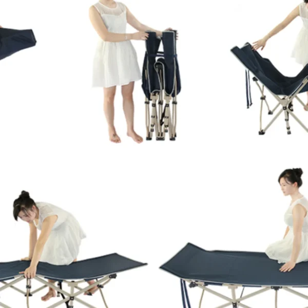
Portable Folding Bed for Office Naps & Outdoor Adventures Rated 5.00 out of 5$168.06 – $305.16Price range: $168.06 through $305.16
-
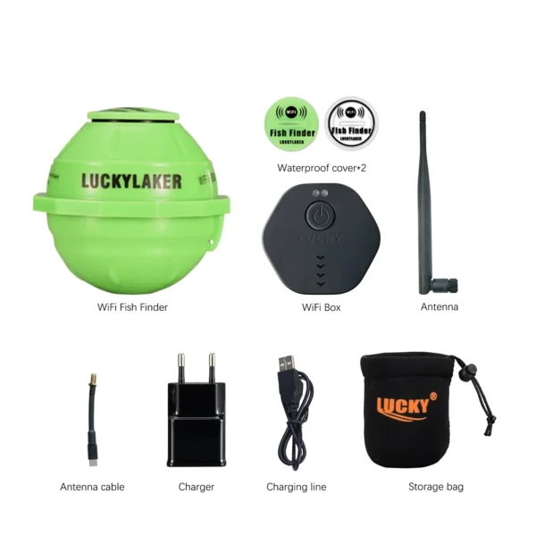
Revolutionize Your Fishing with Lucky Smart Wi-Fi Fish Finder Rated 5.00 out of 5
$197.75Original price was: $197.75.$137.82Current price is: $137.82.

Product Gallery
-
 Ultimate 2-3 Person Inflatable Kayak for Fishing Fun Rated 5.00 out of 5$1,081.72 – $1,095.09Price range: $1,081.72 through $1,095.09
 -
VEVOR 550 lb Heavy-Duty Folding Wagon & Bench for Adventurers
$155.14 – $252.20Price range: $155.14 through $252.20
-
BISINNA One-Touch Titanium Tent for 3-4 Campers, Adventure Ready Rated 4.36 out of 5
$311.78Original price was: $311.78.$217.30Current price is: $217.30.


 Camping Gear
 Camping Chair
 Camping Table
 Camping Bed
 Sleeping Gear
 Storage Bags
 BBQ Portable
 Sleeping Bags
 Camping Tents
 Gazebos
 Outdoor Cooler
 Cookware
 Power
Power Camping Light
 Flashlight
 Portable Solar
 Power Banks
 Fish Finders
 Fishing Bags
 Fishing Jerseys
 Fishing Reels
 Fishing Chairs
 Fishing Bait Boat
 Fishing Floats
 Hard Baits
 Hiking Vests
 Outdoor Bags
 Water Filters
 Paracord
 Walkie Talkie
 Paddleboards
 Boats
Boats Sea Scooter
 Accessories
 Electric Bike
 Electric Scooter
Recent Comments