<h1>Easy Map and Compass Navigation for Your Next Camping Trip</h1>
<p>Ever felt that pull, that irresistible urge to venture beyond the trailhead? To trade marked paths for the whisper of untouched wilderness? Yeah, me too. But here's the thing: that freedom comes with a hefty dose of responsibility. Getting lost isn't just inconvenient; it can be downright dangerous.</p>
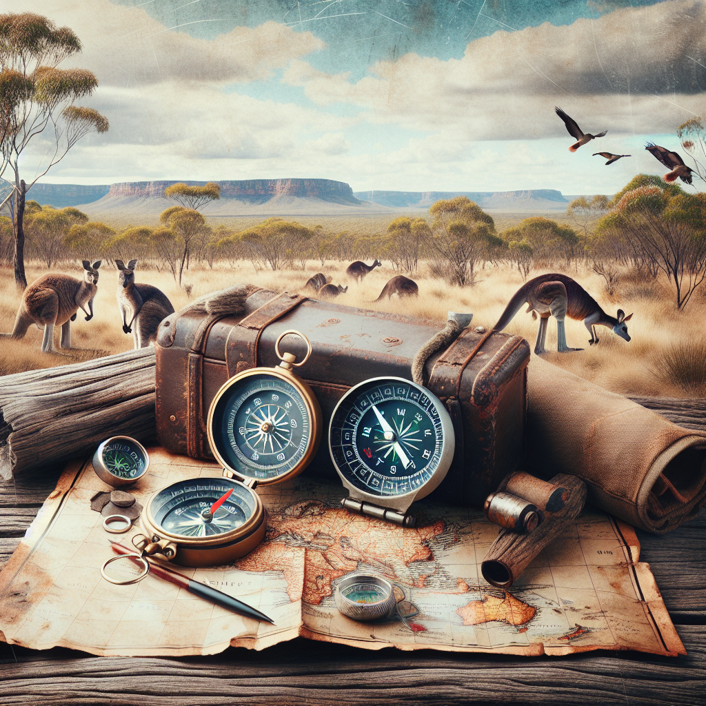
<p>That's where the trusty map and compass come in. Now, I know what you might be thinking: “Aren’t those things, like, totally outdated with GPS and all?” And sure, GPS is great. Until the batteries die, or you lose satellite signal in a deep canyon. A map and compass? Timeless. Reliable. And honestly, pretty empowering once you get the hang of them.</p>
<p>So, let's demystify this whole navigation thing. This isn't about becoming a master cartographer overnight. It’s about gaining the skills to confidently explore, knowing you can find your way back, no matter what.</p>
<h2>Why Bother with a Map and Compass When GPS Exists?</h2>
<p>Let's be real, GPS devices are amazing pieces of tech. They can pinpoint your location with incredible accuracy, show you real-time maps, and even track your progress. But they aren't infallible. What happens when your battery dies miles from civilization? Or when dense tree cover blocks the satellite signal, leaving you with a useless screen? Or worse still, your expensive device gets damaged?</p>
<p>That's where the beauty of a map and compass shines through. No batteries required. No reliance on fickle satellite signals. Just good old-fashioned, reliable technology that's been used for centuries. Think of it like this: GPS is your fancy sports car, but a map and compass are your trusty, all-terrain vehicle that can handle anything the wilderness throws at you. Plus, there's just something satisfying about mastering a skill that connects you to explorers of the past.</p>
<p>Moreover, relying solely on GPS can lead to "digital dependence". We become so reliant on the screen that we fail to observe our surroundings, fostering poor instincts. Map and compass navigation forces you to pay close attention to the terrain, to understand the landscape, and to truly engage with the environment. Its an enrichment, not just a safety measure.</p>
<h2>Understanding the Anatomy of a Topographic Map</h2>
<p>Okay, so you have a map. But what *is* it, exactly? A topographic map, often called a topo map, is a 2D representation of a 3D world. It uses contour lines to show the shape and elevation of the land. Think of it like a bird's-eye view of the terrain, but with extra information baked in.</p>
<h3>Decoding Contour Lines: Hills, Valleys, and Everything In-Between</h3>
<p>Contour lines are the squiggly lines that make topo maps look like intricate spaghetti diagrams. Each line connects points of equal elevation. The closer the lines are together, the steeper the terrain. Widely spaced lines mean a gentler slope. See a series of concentric circles? That's likely a hilltop! Ever seen a 'v' shape? That's usually a valley with the point of the "V" pointing upstream.</p>
<h3>Key Map Features to Look For (and Why They Matter)</h3>
<p>Topo maps are packed with information. Here's a rundown of some key features and why they're important:</p>
<ul>
<li><strong>Legend:</strong> Your map's decoder ring. It explains all the symbols used on the map. Always check the legend first!</li>
<li><strong>Scale:</strong> This tells you the relationship between distances on the map and distances on the ground. For example, a scale of 1:24,000 means that one inch on the map equals 24,000 inches (2,000 feet) in the real world.</li>
<li><strong>North Arrow:</strong> Indicates the direction of true north. This is crucial for orienting your map and taking accurate bearings.</li>
<li><strong>Contour Interval:</strong> This tells you the elevation difference between each contour line. Knowing the contour interval allows you to estimate the steepness of slopes and the height of mountains.</li>
<li><strong>Water Features:</strong> Rivers, lakes, and streams are usually shown in blue. These can be important landmarks and sources of water (though always purify water before drinking it!).</li>
<li><strong>Vegetation:</strong> Forested areas are often shaded green. Knowing the vegetation can help you anticipate terrain challenges and find potential campsites.</li>
<li><strong>Man-made Features:</strong> Roads, trails, buildings, and power lines are usually shown in black or gray. These can be useful for navigation, but remember that they may not always be accurately depicted on the map.</li>
</ul>
<p>Learning to read a topo map takes practice. Start by studying maps of areas you know well. Compare the map to the real-world terrain, and see how the contour lines correspond to the hills and valleys you can see. Over time, you'll develop a "topo map sense" that will allow you to visualize the landscape just by looking at the map.</p>
<h2>Choosing the Right Compass for Camping: A Buyer's Guide</h2>
<p>Not all compasses are created equal. For camping and hiking, you'll want a baseplate compass. These are durable, accurate, and easy to use. Forget the fancy, feature-laden models; stick with a reliable compass from a reputable brand like Suunto or Silva. These brands have earned their stripes, so to speak.</p>
<h3>Understanding the Parts of a Baseplate Compass</h3>
<p>Let's break down the anatomy of a baseplate compass:</p>
<ul>
<li><strong>Baseplate:</strong> The clear plastic base that allows you to lay the compass flat on the map. It usually has a ruler and other measuring tools printed on it.</li>
<li><strong>Magnetic Needle:</strong> The needle that points to magnetic north. It's usually housed in a liquid-filled capsule to dampen its movements.</li>
<li><strong>Rotating Bezel (or Compass Housing):</strong> The rotating ring around the capsule, marked with degrees (0-360).</li>
<li><strong>Orienting Arrow:</strong> An arrow etched into the bottom of the capsule, used to align the compass with the map's north lines.</li>
<li><strong>Orienting Lines:</strong> Parallel lines etched into the bottom of the capsule, used to align with the map's north lines.</li>
<li><strong>Index Line:</strong> A line on the baseplate that you use to read the bearing.</li>
</ul>
<h3>Features to Look For: Durability, Accuracy, and Ease of Use</h3>
<p>When choosing a compass, consider these factors:</p>
<ul>
<li><strong>Durability:</strong> Look for a compass made from sturdy materials that can withstand the rigors of outdoor use. After all, it's going to be banging around in your pack!</li>
<li><strong>Accuracy:</strong> A compass's accuracy depends on the quality of its magnetic needle and the precision of its markings. Read reviews and choose a compass from a reputable brand.</li>
<li><strong>Ease of Use:</strong> The compass should be easy to hold, to read, and to operate, even with gloves on.</li>
<li><strong>Declination Adjustment:</strong> Some compasses have a declination adjustment feature, which allows you to compensate for the difference between magnetic north and true north (we'll talk more about declination later). This isn't strictly necessary, but it can be a convenient feature to have.</li>
</ul>
<h2>Mastering the Art of Taking a Bearing</h2>
<p>Okay, now for the fun part! Taking a bearing is the process of determining the direction from your current location to a specific point. It's the foundation of map and compass navigation. Think of it as your personal guidance system in the wilderness. Trust me; there's nothing quite like the feeling of nailing a complex navigation challenge.</p>
<h3>Step-by-Step Guide to Taking a Bearing from a Map</h3>
<p>Here's how to take a bearing from a map:</p>
<ol>
<li><strong>Orient the Map:</strong> Place the map on a flat surface and rotate it until it's aligned with your surroundings. Use terrain features like mountains, rivers, or roads to help you.</li>
<li><strong>Locate Your Position and Your Destination:</strong> Identify your current location and your destination on the map.</li>
<li><strong>Place the Compass on the Map:</strong> Lay the compass on the map so that the edge of the baseplate runs along the line between your current location and your destination. The direction-of-travel arrow on the baseplate should point toward your destination.</li>
<li><strong>Rotate the Compass Housing:</strong> Rotate the compass housing until the orienting arrow is aligned with the north lines on the map. Make sure that the north end of the orienting arrow points to the north end of the map.</li>
<li><strong>Read the Bearing:</strong> Read the bearing in degrees from the index line on the baseplate. This is the direction you need to travel.</li>
</ol>
<h3>Compensating for Declination: True North vs. Magnetic North</h3>
<p>Here's a tricky bit. The earth's magnetic field isn't perfectly aligned with the geographic North Pole (True North). The difference between true north and magnetic north is called declination. Declination varies depending on your location and changes over time. You can find the declination for your area on a topo map or online.</p>
<p>So, how do you compensate for declination? Well, there are two main methods:</p>
<ul>
<li><strong>Adjusting the Compass:</strong> Some compasses have a declination adjustment feature that allows you to manually adjust the compass to compensate for declination. If your compass has this feature, consult the manufacturer's instructions.</li>
<li><strong>Calculating the Correction Manually:</strong> If your compass doesn't have a declination adjustment feature, you'll need to calculate the correction manually. If the declination is east, subtract the declination angle from your bearing. If the declination is west, add the declination angle to your bearing. Remember: "East is least, West is best."</li>
</ul>
<p>Correcting for declination is crucial for accurate navigation. Otherwise, you could end up miles off course!</p>
<h2>Following a Bearing in the Field: Staying on Course</h2>
<p>Taking a bearing is one thing, but following it in the field is another. It requires patience, attention to detail, and the ability to stay focused, even when the terrain is challenging.</p>
<h3>Using the Compass to Stay on Track</h3>
<p>Here's how to follow a bearing in the field:</p>
<ol>
<li><strong>Hold the Compass Level:</strong> Hold the compass in front of you, making sure that the baseplate is level.</li>
<li><strong>Rotate Your Body:</strong> Rotate your body until the north end of the magnetic needle aligns with the orienting arrow in the compass housing.</li>
<li><strong>Choose a Landmark:</strong> Look ahead and choose a landmark that is on your bearing. This could be a tree, a rock, or a distant hill.</li>
<li><strong>Walk to the Landmark:</strong> Walk toward the landmark, keeping the compass needle aligned with the orienting arrow.</li>
<li><strong>Repeat:</strong> When you reach the landmark, repeat the process. Choose another landmark on your bearing, and walk toward it.</li>
</ol>
<h3>Dealing with Obstacles and Terrain Changes</h3>
<p>Of course, things rarely go according to plan in the wilderness. You'll inevitably encounter obstacles like dense forests, steep cliffs, or impassable rivers. Here's how to deal with them:</p>
<ul>
<li><strong>Go Around:</strong> If possible, simply go around the obstacle. Keep an eye on your compass and try to maintain your bearing as much as possible.</li>
<li><strong>Offset:</strong> If you need to detour significantly, use the offset method. Choose a point to the left or right of your bearing line, and walk to that point. Then, take another bearing back to your original bearing line, and continue on your way.</li>
<li><strong>Backsight:</strong> If you're unsure of your location, use the backsight method. Take a bearing on a known feature behind you, and then compare that bearing to the bearing on your map. This can help you determine your position.</li>
</ul>
<p>Remember, navigation is a skill that improves with practice. Don't be afraid to make mistakes. Just learn from them, and keep practicing.</p>
<h2>Combining Map and Compass Skills: A Real-World Scenario</h2>
<p>Let's put everything together with a hypothetical scenario. Imagine you're hiking in a mountainous area. You've been following a trail for several hours, but you've decided to venture off-trail to explore a nearby peak. You have a topo map of the area and a reliable baseplate compass. You want to reach the summit of the peak, but it's not visible from your current location.</p>
<h3>Planning Your Route: Identifying Landmarks and Potential Hazards</h3>
<p>The first step is to plan your route on the map. Identify the peak you want to reach, and locate your current position. Use the contour lines to assess the terrain between you and the peak. Look for potential hazards like steep cliffs, dense forests, or impassable streams. Identify prominent landmarks that you can use for navigation, such as saddles, ridges, or distinctive rock formations.</p>
<h3>Taking Bearings and Following Your Route</h3>
<p>Once you've planned your route, take a bearing from your current location to the summit of the peak. Correct for declination, and then follow that bearing in the field. Use landmarks to stay on track, and be prepared to adjust your route if you encounter obstacles or terrain changes.</p>
<h3>Verifying Your Position and Making Adjustments as Needed</h3>
<p>As you hike, periodically verify your position on the map. Use the map and compass to identify surrounding landmarks, and compare them to what you see in the field. If you're unsure of your location, use the resection method (taking bearings on two or more known features) to pinpoint your position. Be prepared to make adjustments to your route as needed. The wilderness is unpredictable, so flexibility is key.</p>
<h2>Essential Safety Tips for Map and Compass Navigation</h2>
<p>Navigation is just one aspect of staying safe in the wilderness. Here are some other important safety tips to keep in mind:</p>
<ul>
<li><strong>Tell Someone Your Plans:</strong> Before you head out, tell someone where you're going and when you expect to be back. This way, if something goes wrong, someone will know to look for you.</li>
<li><strong>Check the Weather Forecast:</strong> Weather conditions can change rapidly in the mountains. Check the forecast before you go, and be prepared for unexpected changes.</li>
<li><strong>Carry the Right Gear:</strong> In addition to a map and compass, be sure to carry essential gear like a first-aid kit, extra food and water, a headlamp or flashlight, a knife, and a fire starter.</li>
<li><strong>Dress Appropriately:</strong> Wear layers of clothing that can be easily added or removed to regulate your body temperature.</li>
<li><strong>Be Aware of Wildlife:</strong> Know what types of animals live in the area you're hiking in, and take precautions to avoid encounters.</li>
<li><strong>Know Your Limits:</strong> Don't push yourself beyond your physical or mental limits. It's better to turn back than to risk getting injured or lost.</li>
</ul>
<h2>Advanced Techniques: Beyond the Basics</h2>
<p>So, you've mastered the basics of map and compass navigation. Congratulations! But there's always more to learn. Here are some advanced techniques to take your skills to the next level, taking into consideration that some people are just plain curious.</p>
<h3>Using Resection to Pinpoint Your Location</h3>
<p>Resection is a technique for determining your location by taking bearings on two or more known features. It's useful when you're unsure of your position on the map. To perform a resection, identify two or three prominent landmarks that you can see in the field and locate on the map. Take a bearing on each landmark, and then draw a line on the map along each bearing line. The point where the lines intersect is your approximate location.</p>
<h3>Orienteering: The Sport of Navigation</h3>
<p>Orienteering is a competitive sport that combines navigation with running. Participants use a map and compass to navigate a course through the woods, finding checkpoints along the way. Orienteering is a great way to improve your navigation skills and test your physical fitness.</p>
<h3>Using GPS as a Backup (and Knowing Its Limitations)</h3>
<p>While I've emphasized the importance of map and compass skills, GPS devices can be valuable tools as well, especially as a backup. Learn how to use GPS to mark waypoints, create routes, and track your progress. But remember that GPS devices are not infallible. Always carry a map and compass as a backup, and know how to use them.</p>
<h2>Common Mistakes to Avoid (and How to Fix Them)</h2>
<p>Everyone makes mistakes, especially when they're learning a new skill. Here are some common mistakes to avoid when using a map and compass:</p>
<ul>
<li><strong>Not Orienting the Map:</strong> Failing to orient the map to your surroundings is a recipe for disaster. Always take the time to orient the map before you start navigating.</li>
<li><strong>Ignoring Declination:</strong> Failing to account for declination can lead to significant errors in your bearings. Always check the declination for your area, and adjust your bearings accordingly.</li>
<li><strong>Misreading the Compass:</strong> It's easy to misread the compass, especially in low light or when you're tired. Double-check your readings to make sure you're on the right track.</li>
<li><strong>Relying Too Much on Memory:</strong> Don't rely on your memory to remember your route. Mark your progress on the map, and take notes as you go.</li>
<li><strong>Panicking:</strong> If you get lost, the worst thing you can do is panic. Stay calm, assess the situation, and use your map and compass to find your way back to safety.</li>
</ul>
<h2>Practice, Practice, Practice: Honing Your Skills</h2>
<p>The most important thing you can do to improve your map and compass skills is to practice. Find a local park or forest, and spend some time practicing your navigation skills. Start with simple exercises, like following a bearing between two points. As you become more confident, try more challenging exercises, like navigating a multi-point course. Start small, and gradually increase the challenge.</p>
<p>Additionally, join a hiking club or orienteering group to learn from experienced navigators. There's nothing quite like learning from someone who's been there and done that. And don't be afraid to ask questions. The navigation community is generally very supportive and welcoming.</p>
<p>Ultimately, mastering map and compass navigation is about more than just learning a skill. It's about gaining confidence, independence, and a deeper appreciation for the natural world. It's about knowing that you can venture into the wilderness and find your way back, no matter what challenges you face. And that, my friends, is a pretty empowering feeling.</p>
<h2>FAQ: Map and Compass Navigation</h2>
<div class="faq-item">
<h3 class="faq-question">**Is it difficult to learn map and compass navigation?**</h3>
<p class="faq-answer">Not really! The basics are straightforward, and with a bit of practice, you'll be navigating like a pro. Start with simple exercises and gradually increase the challenge. Don't be afraid to make mistakes – that's how you learn!</p>
</div>
<div class="faq-item">
<h3 class="faq-question">**What's the difference between true north and magnetic north?**</h3>
<p class="faq-answer">True north is the geographic North Pole, while magnetic north is where your compass needle points. The difference between the two is called declination, and it varies depending on your location. You need to compensate for declination when taking bearings to ensure accurate navigation.</p>
</div>
<div class="faq-item">
<h3 class="faq-question">**Do I really need a map and compass if I have a GPS?**</h3>
<p class="faq-answer">Absolutely! GPS devices are great, but they're not infallible. Batteries die, signals get blocked, and devices break. A map and compass are reliable backups that don't require batteries or satellite signals.</p>
</div>
<div class="faq-item">
<h3 class="faq-question">**How do I choose the right map for my camping trip?**</h3>
<p class="faq-answer">Look for a topographic map (topo map) that covers the area you'll be hiking in. Make sure the map is up-to-date and has a scale that's appropriate for your needs. A scale of 1:24,000 is a good choice for most hiking activities. You can find these maps at outdoor retailers or online.</p>
</div>
<div class="faq-item">
<h3 class="faq-question">**What should I do if I get lost while camping?**</h3>
<p class="faq-answer">First, stay calm! Panic can cloud your judgment. Stop where you are and try to determine your last known location on the map. Use your compass to take bearings on surrounding landmarks. If you can't find your way back, stay put and wait for help. Use your whistle or other signaling devices to attract attention.</p>
</div>
<div class="faq-item">
<h3 class="faq-question">**Can I use my smartphone as a compass?**</h3>
<p class="faq-answer">Smartphones do have compass apps, but they're not as reliable or accurate as a dedicated baseplate compass. Plus, smartphone batteries drain quickly, especially in cold weather. It's best to rely on a traditional compass for serious navigation.</p>
</div>
<div class="faq-item">
<h3 class="faq-question">**Where can I find more resources to improve my navigation skills?**</h3>
<p class="faq-answer">There are tons of resources available! Look for books, websites, and online courses on map and compass navigation. Join a local hiking club or orienteering group. And don't be afraid to ask experienced navigators for advice.</p>
</div>
<h2>Resources for Further Learning</h2>
<p>Want to delve deeper into the world of map and compass navigation? Here are some excellent resources to get you started:</p>
<ul>
<li><a href="https://www.rei.com/learn/expert-advice/navigation.html" target="_blank" rel="noopener nofollow">REI Expert Advice on Navigation</a> – Comprehensive guides and tips on using maps, compasses, and GPS devices.</li>
<li><a href="https://www.princeton.edu/~oa/manual/mapcompass.shtml" target="_blank" rel="noopener nofollow">Princeton University Outdoor Action Guide to Map & Compass</a> – A detailed manual covering all aspects of map and compass navigation.</li>
</ul>
<br>
<h4>DISCLAIMER</h4>
Always consult with experienced hikers and local resources before embarking on any outdoor adventure. Navigation is a critical skill that requires practice and a thorough understanding of the terrain and conditions. Be prepared for changing weather conditions and unexpected challenges. Your safety is your responsibility.
<script>
document.addEventListener('DOMContentLoaded', function () {
var faqItems = document.querySelectorAll('.faq-item');
faqItems.forEach(function (item) {
var question = item.querySelector('.faq-question');
question.addEventListener('click', function () {
// Close other open items
faqItems.forEach(function (otherItem) {
if (otherItem !== item && otherItem.classList.contains('open')) {
otherItem.classList.remove('open');
adjustHeight(otherItem); // Reset height for smooth transition
}
});
item.classList.toggle('open');
adjustHeight(item); // Adjust height for the toggled item
});
});
// Function to handle height adjustments
function adjustHeight(item) {
var answer = item.querySelector('.faq-answer');
if (item.classList.contains('open')) {
answer.style.height = answer.scrollHeight + 'px'; // Dynamically set height
} else {
answer.style.height = '0'; // Collapse smoothly
}
}
});
</script>
 Portable 10 W Solar Charger - Power Up Anywhere, Anytime Rated 5.00 out of 5

 VEVOR 550 lb Heavy-Duty Folding Wagon & Bench for Adventurers
$154.92 – $251.84Price range: $154.92 through $251.84
VEVOR 550 lb Heavy-Duty Folding Wagon & Bench for Adventurers
$154.92 – $251.84Price range: $154.92 through $251.84


 Camping Gear
 Camping Chair
 Camping Table
 Sleeping Bags
 Camping Bed
 Sleeping Gear
 Storage Bags
 BBQ Portable
 Camping Tents
 Gazebos
 Outdoor Cooler
 Cookware
 Power
Power Camping Light
 Flashlight
 Portable Solar
 Power Banks
 Fish Finders
 Fishing Bags
 Fishing Jerseys
 Fishing Reels
 Fishing Chairs
 Fishing Bait Boat
 Fishing Floats
 Hard Baits
 Hiking Vests
 Outdoor Bags
 Water Filters
 Paracord
 Walkie Talkie
 Paddleboards
 Boats
Boats Sea Scooter
 Accessories
 Electric Bike
 Electric Scooter
Recent Comments