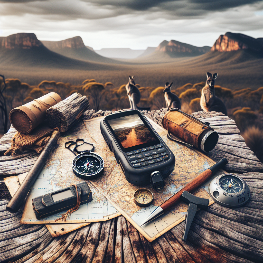
<p>So, you're thinking about venturing into the wild? That's fantastic! But let's be real for a moment. Relying solely on your phone's GPS in the backcountry is like trusting a paper boat in a hurricane. It *might* work, but do you really want to bet your safety on it? This guide is your compass (pun intended!) to mastering the art of navigation, blending the reliability of a map and compass with the convenience of a GPS. Think of it as equipping yourself with the knowledge to confidently explore, knowing you can always find your way back, no matter what.</p>
<h2>Why Learn Traditional Navigation Skills Anyway?</h2>
<p>Let's face it, technology can fail. Batteries die, signals vanish, and sometimes, gadgets just decide to take a vacation of their own, right when you need them most. Learning to navigate with a map and compass is like having a backup plan that doesn't rely on Wi-Fi or charging cables. It builds self-reliance, sharpens your observation skills, and, honestly, there's something deeply satisfying about plotting your course the old-fashioned way.</p>
<p>Think of it like this: knowing how to use a map and compass is like knowing how to drive a stick shift, even if you primarily drive an automatic. It's a fundamental skill that makes you a more versatile and confident adventurer. </p>
<h2>Understanding Maps: Your Paper Roadmap to Adventure</h2>
<p>Maps aren't just pretty pictures of the landscape; they're meticulously crafted tools that translate the three-dimensional world onto a two-dimensional surface. Getting comfortable with map reading is your first crucial step.</p>
<h3>Map Essentials: Scale, Legend, and Orientation</h3>
<p>First things first, every map has a scale. This tells you the ratio between the distance on the map and the corresponding distance on the ground. For example, a scale of 1:24,000 means that one inch on the map equals 24,000 inches (or 2,000 feet) in the real world.  See how crucial that is?</p>
<p>Next up, the legend (or key) explains the symbols used on the map. Expect to see symbols for everything from trails and campsites to water sources and elevation markers. Always take a moment to familiarize yourself with the legend before heading out.</p>
<p>Finally, orientation is key. Knowing how to align your map with the surrounding terrain is essential. You can use a compass to align the map to true north or orient yourself by matching recognizable landmarks on the map to their real-world counterparts.</p>
<h3>Contour Lines: Decoding the Land's Shape</h3>
<p>Contour lines are those squiggly lines on a topographic map that represent elevation. Each line connects points of equal altitude, giving you a sense of the terrain's inclines, declines, and overall shape. Understanding contour lines unlocks a wealth of information. </p>
<p>Closely spaced contour lines indicate a steep slope, while widely spaced lines suggest a gentler gradient. Concentric circles of contour lines usually indicate a hilltop or peak. And "V" shapes pointing uphill often signify valleys or stream beds. Learning to "read" these patterns is like learning a secret language of the land.</p>
<h2>The Compass: Your Magnetic Guide</h2>
<p>The compass – a seemingly simple tool with the power to keep you on course, even when everything else feels uncertain. </p>
<h3>Parts of a Compass: A Quick Tour</h3>
<p>Let's break down the anatomy of a basic baseplate compass. You've got the baseplate itself, a clear rectangular piece with a ruler on the edges for measuring distances on your map.

</p>

<p> Then there's the rotating bezel, marked with degrees from 0 to 360. The magnetic needle, which always points towards magnetic north, floats inside a liquid-filled capsule. Lastly, the orienting arrow and lines help you align the compass with your map.</p>
<h3>Taking a Bearing: Setting Your Course</h3>
<p>Taking a bearing is the process of determining the direction from your current location to a specific point. Here's the basic rundown: First, point the direction-of-travel arrow on your compass towards your destination. Then, rotate the bezel until the orienting arrow aligns with the north end of the magnetic needle. Read the bearing (in degrees) at the index line on the compass.</p>
<p>Remember, this bearing is relative to magnetic north, so you'll need to account for magnetic declination (more on that later!) before using it to navigate.</p>
<h3>Following a Bearing: Staying on Track</h3>
<p>Once you've got your bearing, it's time to put it into practice. Hold the compass in front of you, keeping the direction-of-travel arrow pointed in the direction you want to go. Rotate your body until the north end of the magnetic needle aligns with the orienting arrow. Now, simply walk in the direction the direction-of-travel arrow is pointing.</p>
<p>Sounds easy, right? The trick is to keep checking your compass frequently and making small adjustments as needed. It's also helpful to pick out a landmark in the distance that lies along your bearing and walk towards it, then repeat the process. This prevents you from veering off course due to obstacles or changes in terrain.</p>
<h2>Declination: The Difference Between True North and Magnetic North</h2>
<p>Okay, here's where things get a little bit technical, but stick with me – it's important. True north is the geographical North Pole, the actual top of the planet. Magnetic north, on the other hand, is the point towards which your compass needle points. And guess what? Those two points aren't the same.</p>
<p>The difference between true north and magnetic north is called declination, and it varies depending on your location. In some areas, magnetic north is east of true north (positive declination), while in others, it's west of true north (negative declination). This difference can be significant enough to throw off your navigation if you don't account for it.</p>
<h3>Finding the Declination for Your Area</h3>
<p>The declination for your area is usually printed on your topographic map. It's also available online from various sources. Once you know the declination, you need to adjust your compass bearings accordingly.</p>
<h3>Adjusting for Declination: The Easy Way</h3>
<p>Many modern compasses have an adjustable declination setting. This allows you to compensate for declination by rotating the orienting arrow to match your local declination value. Once you've set the declination, you can take bearings relative to true north without having to do any math.</p>
<p>If your compass doesn't have an adjustable declination, you'll need to add or subtract the declination value from your bearings manually. Remember this easy trick: "East is least, West is best." That means if the declination is east (positive), you subtract it from your bearing. If the declination is west (negative), you add it. Think of it as a handy mnemonic to keep you on the right track. </p>
<h2>Combining Map and Compass: Seamless Navigation</h2>
<p>Now for the fun part – putting it all together! </p>
<h3>Orienting the Map with Your Compass</h3>
<p>Before you start plotting your course, make sure your map is properly oriented. Place your compass on the map, aligning one edge of the baseplate with the north-south grid lines on the map. Rotate the map and compass together until the north end of the magnetic needle aligns with the orienting arrow (taking declination into account, of course!). Now your map is aligned with the terrain around you.</p>
<h3>Planning Your Route: From Point A to Point B</h3>
<p>Identify your starting point and destination on the map. Use a ruler to draw a straight line between the two points. This is your desired route.</p>
<p>Now, place the edge of your compass baseplate along the line you just drew. Rotate the bezel until the orienting arrow aligns with the north-south grid lines on the map. Read the bearing at the index line on the compass. This is the bearing you need to follow to reach your destination. Remember to adjust for declination!</p>
<p>But wait, there's more! Consider any obstacles or changes in terrain along your route. You might need to break your route into smaller segments, each with its own bearing. Mark these segments on your map and take bearings for each one.</p>
<h3>Triangulation: Finding Your Location When You're Lost(ish)</h3>
<p>Okay, let's say you're not *completely* lost, but you're not exactly sure where you are either. Triangulation can help you pinpoint your location using a map and compass. Identify two or three prominent landmarks that you can see in the distance and that are also marked on your map.</p>
<p>Take a bearing to each landmark. Then, use your compass to draw a line on your map along each bearing, extending it back towards your estimated location. The point where the lines intersect is your approximate position.</p>
<p>For even greater accuracy, use three landmarks instead of two. The three lines will likely form a small triangle on your map. Your location is somewhere within that triangle.</p>
<h2>The Camper's GPS: A Modern Twist</h2>
<p>Let's be honest, the Camper's GPS devices are pretty awesome. They can track your location in real-time, display detailed maps, and even provide weather forecasts. But like any technology, they have their limitations. </p>
<h3>When to Use a GPS (and When Not To)</h3>
<p>GPS devices are excellent for: </p>

<ul>

    <li>Marking waypoints and creating routes in advance</li>

    <li>Tracking your progress and distance traveled</li>

    <li>Finding your way back to your starting point</li>

</ul>

<p>However, they're not so great for:</p>

<ul>

    <li>Relying on as your sole navigation tool (batteries die, remember?)</li>

    <li>Teaching you how to read a map or understand terrain</li>

    <li>Replacing your common sense and observation skills</li>

</ul>
<p>Think of your GPS as a helpful assistant, not a replacement for your brain.</p>
<h3>GPS Essentials: Waypoints, Routes, and Tracks</h3>
<p>Understanding how to use waypoints, routes, and tracks is key to effective GPS navigation. A waypoint is a specific location that you mark on your GPS. It could be a campsite, a water source, or any other point of interest.</p>
<p>A route is a series of waypoints that you string together to create a planned course. You can create routes in advance on your computer and then upload them to your GPS.
You see?
<p>A track is a record of your actual movements as you travel. Your GPS automatically records your track as you go, allowing you to retrace your steps if needed. Analyzing your tracks can also give you valuable insights into your hiking speed, elevation gain, and other performance metrics.</p>
<h3>Geocaching: A Fun Way to Practice Your Skills</h3>

<p>Looking for a practical and entertaining way to hone your navigation skills? Consider geocaching! Geocaching is an outdoor treasure hunting game where participants use a GPS device or smartphone to locate hidden containers called "geocaches." These caches can be found all over the world, in both urban and wilderness settings.</p>
<p>Geocaching is a fantastic way to practice using your GPS, reading coordinates, and navigating with a map and compass. It's also a great way to explore new places and have some fun with friends and family. Plus, finding a well-hidden geocache can be incredibly rewarding!</p>
<h2>Safety First: Essential Tips for Navigating the Outdoors</h2>
<p>Safety should always be your top priority when venturing into the backcountry. Here's what to do.</p>
<h3>Planning and Preparation: Setting Yourself Up for Success</h3>
<p>Before you even lace up your boots, take the time to plan your trip carefully. Study your maps, check the weather forecast, and research trail conditions. Let someone know your itinerary and when you expect to return. Pack essential gear like a first-aid kit, extra food and water, and a signaling device (whistle or mirror).</p>
<h3>Staying Aware: Observing Your Surroundings. Let me explain.</h3>
<p>Pay attention to your surroundings as you hike. Note landmarks, changes in terrain, and any signs of wildlife. Keep an eye on the weather and be prepared to adjust your plans if necessary. Trust your instincts – if something feels off, don't hesitate to turn back.</p>
<h3>Emergency Procedures: What to Do When Things Go Wrong</h3>
<p>Despite your best efforts, sometimes things go wrong. If you get lost, stay calm and try to retrace your steps. Use your map and compass to try to determine your location. If you're injured, administer first aid and signal for help. If you need to spend the night in the woods, build a shelter and start a fire for warmth and signaling.</p>
<p>Remember, the key to survival is to stay calm, stay put, and use your knowledge and resources to your advantage.</p>
<h2>Camp Security: Protecting Your Basecamp</h2>
<p>Your campsite is your home away from home, so it's important to take steps to protect it from potential threats.</p>
<h3>Choosing a Safe Campsite: Location, Location, Location</h3>
<p>Select a campsite that is away from hazards like dead trees, steep slopes, and flood zones. Avoid camping near animal trails or water sources, as these areas may attract unwanted visitors.</p>
<h3>Food Storage: Keeping Critters Away</h3>
<p>Proper food storage is crucial to prevent attracting bears, rodents, and other animals to your campsite. Use bear-resistant canisters or hang your food from a tree, at least 10 feet off the ground and 4 feet away from the trunk. Never store food in your tent.</p>
<h3>Securing Your Gear: Deterring Theft</h3>
<p>While theft may not be a common concern in the backcountry, it's still wise to take precautions. Lock valuable items in your car or secure them to a tree or other fixed object. Don't leave your campsite unattended for extended periods of time.</p>
<h2>Advanced Navigation Techniques: Taking It to the Next Level</h2>
<p>Ready to take your navigation skills up a notch? Here are a few advanced techniques to explore.</p>
<h3>Orienteering: The Sport of Navigation</h3>
<p>Orienteering is a competitive sport that combines navigation with running. Participants use a map and compass to navigate a course through unfamiliar terrain, locating a series of checkpoints along the way. Orienteering is a great way to improve your map reading skills, decision-making abilities, and physical fitness.  Honestly, what are you waiting for?</p>
<p>Check out resources like the <a href="https://orienteeringusa.org/" target="_blank" rel="noopener noreferrer">Orienteering USA</a> website for information on local clubs and events.</p>
<h3>Night Navigation: Finding Your Way in the Dark</h3>
<p>Navigating at night presents unique challenges, but it can also be incredibly rewarding. Use a headlamp or flashlight to illuminate your map and compass. Pay close attention to your bearings and distances, and be prepared to move slowly and deliberately. Consider using a GPS device with night vision capabilities.</p>
<h3>Navigating in Challenging Weather Conditions</h3>
<p>Fog, snow, and rain can significantly reduce visibility and make navigation more difficult. Use a waterproof map and compass, and consider using a GPS device with weather alerts. Be prepared to adjust your plans if necessary and don't hesitate to turn back if conditions become too dangerous.</p>
<p>Remember, your safety always comes first. Knowing when to turn back is just as important as knowing how to navigate.</p>
<h2>The Future of Camping Navigation: What Lies Ahead?</h2>
<p>The landscape of camping navigation is constantly evolving, with new technologies and techniques emerging all the time. From advanced GPS devices with satellite communication capabilities to augmented reality apps that overlay digital information onto the real world, the possibilities are endless. </p>
<p>One thing is for certain: the future of camping navigation will be a blend of traditional skills and modern technology. While GPS devices and digital maps will undoubtedly play an increasingly important role, the ability to read a map, use a compass, and understand the terrain will remain essential skills for any backcountry adventurer. After all, technology can fail, but your knowledge and skills will always be with you.</p>
<h2>Last Thoughts</h2>

 <p>So, there you have it – your comprehensive guide to navigating the outdoors with a map and compass. Remember, mastering these skills takes time and practice. Don't be afraid to experiment, make mistakes, and learn from your experiences. With a little dedication and a healthy dose of curiosity, you'll be well on your way to becoming a confident and skilled navigator.</p>
<p>Now go forth, explore, and discover the incredible beauty and wonder of the natural world – safely and responsibly!</p>
<h2>FAQ: Your Navigation Questions Answered</h2>
<div class="faq-question"><b>What's the most important thing to remember when using a map and compass?</b></div>

<div class="faq-answer">

    <p>Understanding declination! It's the difference between true north and magnetic north and can throw off your bearings if you don't account for it.</p>

</div>
<div class="faq-question"><b>Is a GPS really necessary if I have a map and compass?</b></div>

<div class="faq-answer">

    <p>Not necessarily, but it can be a helpful tool. Think of it as a supplement to your map and compass skills, not a replacement. It's beneficial for marking waypoints, tracking your progress, and providing real-time information, but don't rely on it completely.</p>

</div>
<div class="faq-question"><b>How do I choose the right compass for camping?</b></div>

<div class="faq-answer">

    <p>Look for a baseplate compass with a liquid-filled capsule, a rotating bezel, and an adjustable declination setting. A clear baseplate makes it easier to align the compass with your map.</p>

</div>
<div class="faq-question"><b>What does 'orienting the map' actually mean?</b></div>

<div class="faq-answer">

    <p>It means aligning your map with the terrain around you. You do this by using your compass to align the north direction on the map with true north (or magnetic north, accounting for declination) in the real world.</p>

</div>
<div class="faq-question"><b>How can I practice my map and compass skills?</b></div>

<div class="faq-answer">

    <p>Start by practicing in a familiar area, like a local park. Use a map to identify landmarks and plan a route, then use your compass to follow that route. You can also participate in orienteering events or go geocaching.</p>

</div>
<div class="faq-question"><b>What should I do if I get lost in the woods?</b></div>

<div class="faq-answer">

    <p>Stay calm. Assess your situation, and try to retrace your steps to the last known location. If you have a map and compass, use triangulation to determine your approximate location. If you have a GPS device, try to mark your current location and find a route back to safety. If you can't find your way, stay put, build a shelter, and signal for help.</p>

</div>
<div class="faq-question"><b>What is the most common mistake people make when navigating with a map and compass?</b></div>

<div class="faq-answer">

    <p>Failing to account for declination. This can lead to significant errors in your bearings and cause you to veer off course. Always check the declination for your area and adjust your compass accordingly.</p>

</div>
<br>

<hr>

<h4>DISCLAIMER</h4>

<p>Please note that while this article aims to provide comprehensive guidance on outdoor navigation, it is not a substitute for professional training or experience. Always exercise caution and good judgment when venturing into the backcountry. Weather conditions, terrain, and other factors can change rapidly, and it's essential to be prepared for any eventuality. The author and publisher are not responsible for any injury, loss, or damage resulting from the use of the information contained in this article.</p>
<!-- end disclaimer -->
<script>

    // JavaScript for FAQ functionality

    document.addEventListener('DOMContentLoaded', function() {

        const questions = document.querySelectorAll('.faq-question');
questions.forEach(question => {

            question.addEventListener('click', function() {

                const answer = this.nextElementSibling;

                if (answer.classList.contains('faq-active')) {

                    answer.classList.remove('faq-active');

                } else {

                    // Close any open answers before opening the current one (optional)

                    questions.forEach(q => {

                        const otherAnswer = q.nextElementSibling;

                        if (otherAnswer !== answer && otherAnswer.classList.contains('faq-active')) {

                            otherAnswer.classList.remove('faq-active');

                        }

                    });

                    answer.classList.add('faq-active');

                }

            });

        });

    });

</script>Categories
- Navigation & Safety (68)
- Shelter & Sleep (72)
Top rated products
-
 Ultimate AONIJIE Soft Flask 1000 ml/2000 ml with Water Filter Rated 5.00 out of 5
$41.58Original price was: $41.58.$28.98Current price is: $28.98. -
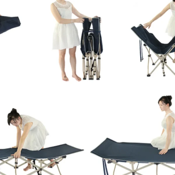
Portable Folding Bed for Office Naps & Outdoor Adventures Rated 5.00 out of 5$168.06 – $305.16Price range: $168.06 through $305.16
-
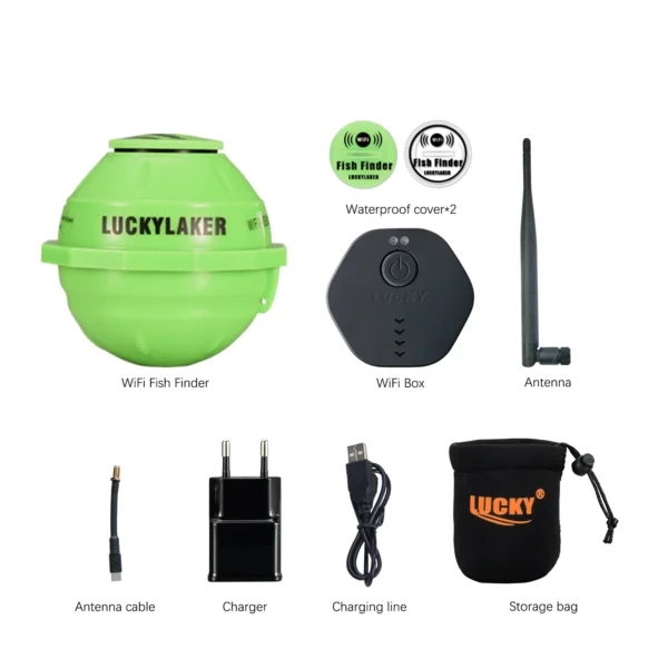
Revolutionize Your Fishing with Lucky Smart Wi-Fi Fish Finder Rated 5.00 out of 5
$197.75Original price was: $197.75.$137.82Current price is: $137.82.

Product Gallery
-
 Ultimate 2-3 Person Inflatable Kayak for Fishing Fun Rated 5.00 out of 5$1,081.72 – $1,095.09Price range: $1,081.72 through $1,095.09
 -
VEVOR 550 lb Heavy-Duty Folding Wagon & Bench for Adventurers
$155.14 – $252.20Price range: $155.14 through $252.20
-
BISINNA One-Touch Titanium Tent for 3-4 Campers, Adventure Ready Rated 4.36 out of 5
$311.78Original price was: $311.78.$217.30Current price is: $217.30.


 Camping Gear
 Camping Chair
 Camping Table
 Camping Bed
 Sleeping Gear
 Storage Bags
 BBQ Portable
 Sleeping Bags
 Camping Tents
 Gazebos
 Outdoor Cooler
 Cookware
 Power
Power Camping Light
 Flashlight
 Portable Solar
 Power Banks
 Fish Finders
 Fishing Bags
 Fishing Jerseys
 Fishing Reels
 Fishing Chairs
 Fishing Bait Boat
 Fishing Floats
 Hard Baits
 Hiking Vests
 Outdoor Bags
 Water Filters
 Paracord
 Walkie Talkie
 Paddleboards
 Boats
Boats Sea Scooter
 Accessories
 Electric Bike
 Electric Scooter
Recent Comments