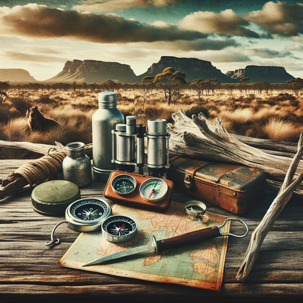
Becoming a Wilderness Navigator: Essential Map and Compass Skills for Camping
Venturing into the wilderness is an experience unlike any other. The tranquility, the challenge, the sheer beauty of nature – it’s addictive, right? But let’s keep it real: getting lost out there isn’t exactly a walk in the park. That’s where mastering map and compass skills comes in. Forget relying solely on your phone; learn to navigate the old-school way, and you’ll not only stay safe but also gain a deeper connection with the landscape. So, ready to become a true wilderness navigator? Let’s get started!
Why Learn Map and Compass Skills? It’s More Than Just “Old School”
Okay, I get it. We live in a world of GPS and fancy gadgets. But here’s the thing: technology can fail. Batteries die, signals disappear, and suddenly you’re relying on something that’s as useful as a paperweight. Map and compass skills, on the other hand? They’re reliable, independent, and they’ll never need charging. They also help you really *see* the land around you, in a way a GPS just can’t.
- Reliability: No batteries required. Enough said.
- Independence: Navigate anywhere, regardless of cell service.
- Enhanced Awareness: Connect with the landscape on a deeper level.
- Essential Backup: A crucial skill when technology fails.
Understanding Topographic Maps: Reading the Language of the Land
Think of a topographic map as a 3D model of the terrain, squashed onto a flat piece of paper. It uses contour lines, symbols, and colors to show you everything from elevation changes to vegetation types. Learning to “read” a topo map is like learning a new language, but trust me, it’s a language worth knowing. It also becomes fun once you get the hang of it. It’s like deciphering a secret code, and the reward is safe passage and a richer understanding of where you are.
Contour Lines: Decoding Elevation Changes
These are the squiggly lines that represent points of equal elevation. The closer the lines are together, the steeper the slope. Wide spacing? Gentle terrain. It’s that simple! Each line represents a specific elevation, and the contour interval (the difference in elevation between adjacent lines) is usually noted on the map legend. Being able to visualize the terrain based on contour lines is a core skill for map reading.
Map Symbols: A Visual Dictionary of the Landscape
From roads and rivers to buildings and forests, maps are filled with symbols. There’s a symbol for just about everything, and familiarizing yourself with these symbols is key to understanding what’s around you. The USGS (United States Geological Survey) is a great resource if you want to learn more about the various map symbols used in the United States. USGS Topo Maps
Map Scale: Bridging the Gap Between Map and Reality
Map scale tells you the relationship between distances on the map and corresponding distances on the ground. It’s often expressed as a ratio (e.g., 1:24,000), which means that one unit of measurement on the map equals 24,000 of the same units on the ground. Understanding map scale is essential for accurately estimating distances and planning your route. Knowing that one inch on the map equals, say, half a mile in reality is pretty valuable.
The Compass: Your Trusty Direction Finder
The compass is your indispensable tool for determining direction. While there are many types of compasses, the baseplate compass (also known as an orienteering compass) is the most common and versatile for wilderness navigation. It’s simple to use, accurate, and relatively inexpensive.
Understanding Compass Components
Let’s break down the key parts of a baseplate compass:
- Baseplate: The clear plastic base that allows you to see the map beneath.
- Magnetic Needle: The red-tipped needle that always points to magnetic north.
- Rotating Bezel (Compass Housing): A rotating ring marked with degrees (0-360).
- Orienting Arrow: An arrow inside the compass housing used to align the compass with the map.
- Declination Adjustment: A mechanism to compensate for the difference between magnetic north and true north (more on that later).
Taking a Bearing: Finding Your Way
Taking a bearing involves using your compass to determine the direction to a specific landmark or way-point. Here’s the basic process:
- Point the direction-of-travel arrow on the baseplate towards the object.
- Hold the compass level and rotate the compass housing until the red end of the magnetic needle aligns with the orienting arrow.
- Read the bearing in degrees from the index line.
Following a Bearing: Staying on Course
Once you have a bearing, you need to follow it. Here’s how:
- Hold the compass level and rotate your body until the red end of the magnetic needle aligns with the orienting arrow.
- Pick a landmark in the direction of travel (a tree, a rock, etc.).
- Walk to that landmark, and repeat the process.
Putting It All Together: Map and Compass in Action
Now that you understand maps and compasses individually, it’s time to combine them! This is where the real magic happens. Learning to orient your map is the first step to using your map and compass together, so let’s cover the steps.
Orienting the Map: Aligning Map and Reality
Orienting the map means aligning it with the real world, so that the features on the map match the corresponding features on the ground. You can do this with a compass:
- Place the compass on the map.
- Rotate the map until the north end of the magnetic needle points to the north on the map. Account for declination (more on this shortly).
Planning a Route: From Point A to Point B
Before you hit the trail, take the time to plan your route on the map. Identify key landmarks, estimate distances, and note any potential hazards. Consider elevation changes and terrain types. It’s always a good idea to have a backup plan in case you encounter unexpected obstacles.
Triangulation: Pinpointing Your Location
If you’re unsure of your location, triangulation can help you pinpoint it. This involves taking bearings to two or three visible landmarks and then plotting those bearings on the map. The intersection of the bearings will give you your approximate location. Pro Tip: Use the most distant landmarks possible to improve accuracy!
Declination: The Pesky Angle You Can’t Ignore
Here’s the deal: your compass points to magnetic north, but maps are oriented to true north (also known as geographic north, which is where the grid lines converge on a map). The difference between magnetic north and true north is called declination, and it varies depending on your location. Ignoring declination can lead to significant errors in navigation.
Understanding Declination
Declination can be either east (magnetic north is east of true north) or west (magnetic north is west of true north). The amount of declination is usually indicated on the map legend. You can also find the declination for your specific location online.
Adjusting for Declination
There are two main ways to adjust for declination:
- Adjustable Compass: Some compasses have a declination adjustment screw that allows you to set the declination directly on the compass. Once set, you don’t need to worry about it.
- Manual Adjustment: If your compass doesn’t have a declination adjustment, you need to manually add or subtract the declination when taking bearings. Remember this simple rule: “Add East, Subtract West.”
Navigation in Different Terrains: Adapting to the Environment
Navigating in the mountains is different than navigating in the desert, or in dense forest. Each terrain presents unique challenges and requires different strategies. So, it’s pretty useful to learn about the specific features of the region you’ll be in.
Mountainous Terrain
Steep slopes, obscured visibility, and rapidly changing weather conditions are common challenges in mountainous terrain. Pay close attention to contour lines, use prominent landmarks, and be prepared for sudden changes in weather.
Forested Terrain
Dense forests can limit visibility and make it difficult to maintain a straight course. Use shorter compass legs, pay attention to subtle changes in vegetation, and be aware of potential hazards like deadfall.
Desert Terrain
Vast open spaces, lack of landmarks, and extreme temperatures are characteristic of desert terrain. Use distant landmarks, be aware of mirages, and carry plenty of water. Sun cups can also throw off a compass bearing slightly.
Advanced Navigation Techniques: Taking Your Skills to the Next Level
Once you’ve mastered the basics, you can explore more advanced navigation techniques:
Using an Altimeter
An altimeter measures altitude, which can be helpful for confirming your location and tracking your progress, especially in mountainous terrain. It really helps to see if you’re where you think you are.
Night Navigation
Navigating at night requires extra caution and skill. Use a headlamp with a red filter to preserve your night vision, and be extra careful when following bearings.
GPS Integration
While map and compass skills are essential, GPS devices can be a valuable supplement. Learn how to use a GPS in conjunction with your map and compass to enhance your navigation skills without solely relying on the GPS and its battery life. Knowing how to input map coordinates into a GPS is also useful.
Essential Gear for Wilderness Navigation: Equipping Yourself for Success
Having the right gear is crucial for safe and effective wilderness navigation. Here are the essentials:
- Topographic Map: A detailed map of your intended area.
- Baseplate Compass: A reliable and accurate compass.
- Altimeter Watch: It shows the elevation.
- Headlamp: For navigation at night or in low-light conditions.
- Notebook and Pencil: For recording bearings, distances, and other important information.
Safety Considerations: Staying Safe in the Wilderness
Wilderness navigation is not without its risks. Here are some safety considerations to keep in mind:
- Tell Someone Your Plans: Always let someone know your intended route and estimated return time.
- Check the Weather Forecast: Be aware of potential weather hazards.
- Carry Emergency Supplies: Pack a first-aid kit, extra food and water, a fire starter, and a signaling device.
- Be Aware of Wildlife: Know how to respond to encounters with wild animals.
- Know Your Limits: Don’t push yourself beyond your capabilities.
Practice, Practice, Practice: Honing Your Skills
Like any skill, wilderness navigation requires practice. Start with simple exercises in familiar areas, and gradually increase the difficulty as you gain confidence. Join a local hiking group or orienteering club to learn from experienced navigators. The more you practice, the more comfortable and confident you’ll become.
Conclusion: Embrace the Adventure
Mastering map and compass skills is an investment in your safety, your confidence, and your connection with the wilderness. It’s also pretty cool to know you have the skills to find your way no matter what. So, grab a map, grab a compass, and get out there and explore. The wilderness is calling!
Frequently Asked Questions (FAQ)
DISCLAIMER
Wilderness navigation involves inherent risks. This article is intended for informational purposes only and does not constitute professional advice. Always use caution, practice responsible decision-making, and seek proper training before venturing into the wilderness. The author and publisher are not responsible for any injuries, losses, or damages that may occur as a result of using the information in this article. Always carry appropriate safety gear and be prepared for unexpected situations. Check for updated regulations and guidelines from local authorities and land management agencies, as wilderness conditions can change rapidly. Do not rely solely on this guide for life-saving or safety decisions.
Categories
- Navigation & Safety (68)
- Shelter & Sleep (72)
Top rated products
-
 Compact 70 CM Fishing Rod Bag - Your Adventure Awaits! Rated 5.00 out of 5$14.20 – $18.17Price range: $14.20 through $18.17
 -
Elevate Your Fishing with C118 GPS Remote Bait Boat Rated 5.00 out of 5
$307.61Original price was: $307.61.$214.40Current price is: $214.40. -
CNSUP 12 ft Inflatable Yellow Paddle Board - Adventure Awaits! Rated 5.00 out of 5$280.24 – $479.36Price range: $280.24 through $479.36


Product Gallery
-
 Ultimate 2-3 Person Inflatable Kayak for Fishing Fun Rated 5.00 out of 5
$1,537.10Original price was: $1,537.10.$1,071.31Current price is: $1,071.31. -
VEVOR 550 lb Heavy-Duty Folding Wagon & Bench for Adventurers
$154.16 – $250.60Price range: $154.16 through $250.60
-
Adventure-Ready Ultra Bright LED Headlamp with 3 Modes
$4.63 – $21.74Price range: $4.63 through $21.74


 Camping Gear
 Camping Chair
 Camping Table
 Sleeping Bags
 Camping Bed
 Sleeping Gear
 Storage Bags
 BBQ Portable
 Camping Tents
 Gazebos
 Outdoor Cooler
 Cookware
 Power
Power Camping Light
 Flashlight
 Portable Solar
 Power Banks
 Fish Finders
 Fishing Bags
 Fishing Jerseys
 Fishing Reels
 Fishing Chairs
 Fishing Bait Boat
 Fishing Floats
 Hard Baits
 Hiking Vests
 Outdoor Bags
 Water Filters
 Paracord
 Walkie Talkie
 Paddleboards
 Boats
Boats Sea Scooter
 Accessories
 Electric Bike
 Electric Scooter
Recent Comments