
Why You Still Need a Map and Compass (Even with GPS)
Okay, let’s be real. We’re living in a digital age, right? GPS devices are everywhere. Smartphones have maps. So, why even bother with a map and compass? Well, picture this: you’re deep in the backcountry, miles from civilization. Your phone dies. Your GPS unit malfunctions. Suddenly, that trusty map and compass aren’t just quaint relics – they’re your lifeline.
GPS is great, no doubt. Convenient, accurate (usually), and packed with features. But electronics fail. Batteries die. Satellite signals get blocked by dense forests or steep canyons. And honestly, relying solely on technology can make you a bit complacent. You stop paying attention to your surroundings. You lose your sense of direction. Kind of like relying too much on spellcheck and forgetting how to actually spell.
A map and compass demand your attention. They force you to observe the landscape, to understand terrain features, and to actively participate in navigation. It’s a skill, not just a convenience. Besides, there’s a certain satisfaction that comes from knowing you can find your way using nothing but your own wits and a couple of simple tools. It’s empowering. Think of it as a backup plan—a reliable, analog backup plan that doesn’t require charging.
Understanding the Anatomy of a Topographic Map
A map is more than just a pretty picture; it’s a scaled-down, symbolic representation of the real world. Topographic maps, in particular, show not just where things are, but also the shape of the land – its hills, valleys, and slopes. Learning to “read” a topo map is like learning a new language, but trust me, it’s a language worth knowing.
First, let’s talk about scale. The scale tells you the relationship between the distance on the map and the actual distance on the ground. A scale of 1:24,000 (a common scale for USGS topo maps) means that one inch on the map represents 24,000 inches (or 2,000 feet) on the ground. Understanding the scale is crucial for estimating distances and planning your route. You wouldn’t try to cross a river shown as a tiny blue line if you knew that line represented something a quarter mile wide.
Next up: contour lines. These are the squiggly brown lines that connect points of equal elevation. The closer the contour lines are to each other, the steeper the slope. Widely spaced lines indicate a gentle slope or flat ground. Concentric circles of contour lines usually indicate a hilltop or a mountain. Pay attention to the contour interval (the difference in elevation between adjacent contour lines) – it’s usually printed in the map’s margin.
Don’t forget about symbols! Maps use a variety of symbols to represent features like roads, trails, buildings, water bodies, and vegetation. There’s a legend in the map’s margin that explains what each symbol means. Spend some time familiarizing yourself with these symbols – it’ll make interpreting the map much easier. A blue line might seem obvious for a river, but what about a dashed blue line? What about a green area versus a white area? These things matter.
Finally, all maps need a north arrow. This indicates the direction of true north (the geographic North Pole). It’s often accompanied by declination information, which we’ll get to later. The north arrow is your reference point for orienting the map and taking bearings.
Deconstructing the Compass: Your Directional Ally
The compass: a deceptively simple device that’s been guiding travelers for centuries. While there are many different types of compasses, the most common type for backcountry navigation is the baseplate compass. It’s reliable, durable, and relatively easy to use. Plus, it’s not as expensive as some of the more high-tech options out there. Think of it as the Swiss Army knife of navigation tools.
The key component of a compass is, of course, the magnetic needle. This floats freely on a pivot and aligns itself with the Earth’s magnetic field. The needle is usually colored (red is common) to distinguish the north end from the south end. That’s a critical detail, trust me.
The baseplate is a clear plastic rectangle that serves as the foundation of the compass. It has a straight edge that you can use to draw lines on the map and measure distances. Many baseplates also have a ruler along one or more edges.
The rotating bezel (or compass housing) surrounds the magnetic needle. It’s marked with degrees (0 to 360) and cardinal directions (N, E, S, W). You rotate the bezel to set your bearing.
Inside the rotating bezel is the orienting arrow (also called the “shed”). This is a fixed arrow that you align with the north end of the magnetic needle when taking a bearing.
Lastly, there are declination adjustment screws or settings on some compasses. These allow you to compensate for the difference between true north and magnetic north (more on that in a bit). If yours doesn’t have these, don’t sweat it—you can still manage without them.
True North vs. Magnetic North: Declination Explained
Okay, this is where things can get a little confusing, but stick with me. True north is the geographic North Pole – the point all lines of longitude converge. Magnetic north, on the other hand, is the point towards which your compass needle points. The problem is, true north and magnetic north aren’t in the same place. The difference between them is called declination.
Declination varies depending on your location on Earth and changes over time as the Earth’s magnetic field shifts. It can be expressed as either east declination (magnetic north is east of true north) or west declination (magnetic north is west of true north). The amount of declination for your area is usually indicated on the topographic map.
Why does declination matter? Because if you don’t account for it, your bearings will be off, and you’ll end up going in the wrong direction. Think of it like this: imagine you’re aiming a rifle at a target, but the sights are misaligned. You might be aiming straight ahead, but the bullet will go off to the side. Declination is like that misalignment of the sights. It’s what makes the difference between hitting your target and missing it completely.
So, how do you correct for declination? There are two main methods. One is to adjust your compass if it has declination adjustment screws. The other is to add or subtract the declination angle from your bearings. If you’re using a map with a declination diagram, it will usually tell you whether to add or subtract.
Honestly, declination is one of those things that seems complicated at first, but once you understand the concept, it becomes second nature. Don’t let it intimidate you. Practice correcting for declination in your backyard or a local park until you feel comfortable with it.
Orienting Your Map: Aligning Reality with Paper
Before you can start navigating with a map and compass, you need to orient the map. Orienting simply means aligning the map so that it corresponds with the actual terrain around you. It’s like turning the map into a miniature version of the landscape.
The easiest way to orient a map is to use your compass. First, lay the map flat on the ground. Then, place your compass on the map. Rotate the entire map until the north end of the magnetic needle aligns with north on the map (taking declination into account, of course!).
Once the map is oriented, you can start to identify features on the map and match them to features on the ground. Look for prominent landmarks like peaks, valleys, rivers, and roads. Use these features to confirm that you’re in the right location. You know what? This is a really useful technique if you think you’re lost: it can quickly confirm your location or help you realize you’re way off.
Orienting the map helps you develop a mental picture of the surrounding terrain. It allows you to visualize the landscape in three dimensions and to plan your route accordingly. It’s also a great way to improve your map-reading skills.
There’s also a second method for orienting the map. Without a compass, you can still orient your map by using terrain association. By matching land features around you with land features on the map, turning till features are generally around where they show up on the paper in front of you, you can orient the map reasonably well.
Taking a Bearing: Finding Your Way
Taking a bearing is the process of determining the direction from your current location to a specific point (either on the map or in the real world). A bearing is expressed as an angle, measured in degrees, from north.
To take a bearing to a distant object, hold your compass in front of you. Point the direction-of-travel arrow (on the baseplate) towards the object. Rotate the bezel until the orienting arrow aligns with the north end of the magnetic needle. Read the bearing at the index line (the point where the baseplate meets the rotating bezel). Remember to correct for declination!
To take a bearing from the map, first identify your current location and your destination on the map. Place the edge of the baseplate so that it connects your current location with your destination. Make sure the direction-of-travel arrow points towards your destination (otherwise, you’ll be going in the opposite direction!). Rotate the bezel until the orienting arrow aligns with north on the map. Read the bearing at the index line and correct for declination.
Once you have a bearing, you can follow it to your destination. Keep the compass in front of you and walk in the direction indicated by the direction-of-travel arrow. Make sure to keep the orienting arrow aligned with the north end of the magnetic needle. If you start to drift off course, adjust your direction accordingly.
Let me explain something: practice taking bearings in different terrains and under different conditions. The more you practice, the more comfortable you’ll become with the process. And the more comfortable you are, the more likely you are to stay on course.
Following a Bearing: Staying On Course
Okay, you’ve got your bearing. Now what? Now you need to actually follow it. This might sound simple, but it requires focus and attention to detail.
The key to following a bearing is to keep the orienting arrow aligned with the north end of the magnetic needle. As you walk, periodically check your compass to make sure you’re still on course. If the needle starts to drift away from the orienting arrow, adjust your direction accordingly.
Terrain can make it difficult to follow a straight line. Obstacles like trees, rocks, and streams can force you to deviate from your bearing. When you encounter an obstacle, choose a point on the other side that’s still on your bearing line. Walk to that point, then repeat the process. This technique is called “circumventing” or “dog-legging.”
Visibility can also be a challenge. In dense forests or foggy conditions, you might not be able to see very far. In these situations, choose a landmark (like a distinctive tree or rock) that’s on your bearing line and walk to it. Then, repeat the process. This technique is called “aiming off.”
While you might think you have to always travel in a straight line, that’s not the case. If the terrain allows, feel free to adjust your route slightly to avoid obstacles or to make the going easier. Just make sure you stay generally on course and that you’re aware of your surroundings. After all, navigation is about getting to your destination, not about sticking rigidly to a line on a map.
Triangulation: Pinpointing Your Location
Sometimes, you might find yourself in a situation where you’re not sure of your exact location on the map. This is where triangulation comes in. Triangulation is the process of determining your position by taking bearings to two or more known landmarks.
To triangulate your position, first, identify two or three prominent landmarks that are visible from your location and are also marked on the map. Take a bearing to each landmark. Convert these bearings to back bearings (by adding 180 degrees to the bearing if it’s less than 180 degrees, or subtracting 180 degrees if it’s greater than 180 degrees).
On the map, locate the landmarks you used for your bearings. Using a protractor or the degree markings on your compass, draw a line from each landmark along the back bearing line. The point where the lines intersect is your approximate location. It’s a surprisingly effective method, even in dense terrain.
Keep in mind that triangulation is not an exact science. The accuracy of your triangulation depends on the accuracy of your bearings and the accuracy of the map. It’s always a good idea to confirm your location using other methods (like terrain association) if possible.
A bit off the beaten path, triangulation isn’t just for finding yourself on a map. Surveyors use it, engineers use it, and even wildlife biologists use it to track animal movements. It’s a fundamental technique with applications far beyond backpacking.
Route Planning: From Point A to Point B
Before you even set foot on the trail, spend some time planning your route. Route planning involves studying the map, identifying potential hazards, and making decisions about the best way to get from point A to point B. I guess you could say it makes for a less stressful hike. It’s about making smart choices before you face unexpected situations.
Start by identifying your starting point and your destination on the map. Then, look for potential routes that connect those two points. Consider the terrain along each route. Are there steep climbs? Are there water crossings? Are there dense forests or open meadows?
Pay attention to the elevation profile of your route. A route that looks short on the map might actually involve a lot of climbing. Use the contour lines to estimate the steepness of the slopes.
Identify potential hazards like cliffs, avalanche zones, and unstable terrain. Make sure you have a plan for dealing with these hazards. Are there alternative routes you can take? Do you need to bring special equipment? Honestly, over-preparation beats under-preparation every time.
Consider the time of year and the weather conditions. A route that’s easy in the summer might be impassable in the winter. Check the weather forecast before you go and be prepared for changing conditions. If you haven’t already, purchase extra clothing for unexpected weather conditions. It’s better to have it and not need it, than to need it and not have it.
Finally, make sure you have a backup plan. What will you do if you get lost? What will you do if someone gets injured? What will you do if the weather turns bad? It’s always better to be prepared for the unexpected.
Night Navigation: Finding Your Way in the Dark
Navigating at night presents a unique set of challenges. Visibility is limited, terrain features are harder to identify, and it’s easy to become disoriented. But with the right skills and equipment, you can safely navigate in the dark.
First and foremost, you’ll need a good headlamp or flashlight. Make sure it’s bright enough to illuminate the trail clearly, but not so bright that it blinds you or other hikers. Consider bringing a backup light in case your primary light fails. Also, learn about the different types of lights available, from LED to incandescent: it matters.
Use your map and compass to plan your route in advance. Identify key landmarks that you can use to stay on course. Pay attention to the terrain and look for features that will be easy to recognize in the dark (like rock overhangs, distinctive trees, or changes in slope).
Take frequent compass bearings to ensure you’re staying on course. Use a red-light filter on your headlamp to preserve your night vision. Red light doesn’t affect your eyes as much as white light, so you’ll be able to see better in the dark.
Be extra cautious when crossing streams or navigating steep terrain. The darkness can make it difficult to judge distances and slopes. Slow down and take your time.
If you become disoriented, stop and take a bearing to a known landmark. Use your map and compass to determine your location. Don’t wander aimlessly – that’s a surefire way to get even more lost.
While it’s a little unnerving for some, night navigation can be incredibly rewarding. The quiet, the stars, the sense of accomplishment… it’s a completely different experience from hiking during the day.
Navigation Apps: Integrating Technology Wisely
Okay, we talked about why map and compass skills are essential, but that doesn’t mean you should completely ignore technology. Navigation apps can be a valuable supplement to your traditional navigation skills. Just don’t rely on them completely.
There are many different navigation apps available, each with its own strengths and weaknesses. Some apps use pre-downloaded topographic maps, while others rely on cellular data to access maps. Some apps offer features like GPS tracking, route planning, and waypoint marking.
When choosing a navigation app, consider its accuracy, reliability, and ease of use. Make sure the app works offline, so you can use it even when you don’t have cellular service. Download the maps for your area before you leave home.
Use navigation apps to supplement your map and compass skills, not to replace them. Practice using the app in conjunction with your map and compass, so you can switch seamlessly between the two if necessary. A tool like Gaia GPS is very popular. Others use CalTopo. The point isn’t just to have the app, but to know it well.
Be aware of the limitations of navigation apps. GPS signals can be unreliable in dense forests or steep canyons. Battery life can be a concern, especially on long trips. And apps can crash or malfunction. If you have a little extra money or are in the industry, investing in a good satellite phone or communicator is a good option for emergency purposes.
Honestly, the best approach is to use technology wisely. Use navigation apps as a tool to enhance your navigation skills, not to replace them. And always carry a map and compass as a backup.
Staying Safe: Essential Navigation Practices
Navigation isn’t just about getting from point A to point B. It’s also about staying safe. Poor navigation can lead to getting lost, injured, or even killed. But by following a few essential navigation practices, you can minimize your risk and enjoy a safe and successful trip.
Always tell someone where you’re going and when you expect to be back. Leave a detailed itinerary with a friend or family member. This way, if something goes wrong, someone will know where to start looking for you.
Check the weather forecast before you go and be prepared for changing conditions. Pack appropriate clothing and gear for the expected weather. Carry extra food and water in case you get delayed. It’s an often-repeated piece of advice for good reason.
Stay aware of your surroundings. Pay attention to the terrain, the weather, and your physical condition. Don’t push yourself too hard. Take breaks when you need them.
If you get lost, don’t panic. Stop and assess the situation. Use your map and compass to determine your location. If you can’t find your way, stay put and wait for help. It’s a hard thing to tell yourself, but staying put often brings better results than wandering aimlessly.
Carry a first-aid kit and know how to use it. Learn basic wilderness survival skills like building a shelter, starting a fire, and finding water. These skills can save your life in an emergency.
Respect the environment. Leave no trace of your passage. Pack out everything you pack in. Stay on established trails. Don’t disturb wildlife or vegetation. Protecting our wild places ensures they’ll be there for future adventures.
Practicing Makes Perfect: Honing Your Skills
Like any skill, navigation requires practice. The more you practice, the better you’ll become. And the better you are, the more confident and capable you’ll be in the backcountry.
Start by practicing in a familiar environment. Use your map and compass to navigate around your neighborhood or local park. Take bearings to different objects and follow them. Orient your map and identify landmarks. Get comfortable with the basic techniques before you venture into more challenging terrain.
Join a local hiking or orienteering club. These clubs offer opportunities to learn from experienced navigators and to practice your skills in a group setting. You can also participate in orienteering competitions, which can be a fun and challenging way to test your navigation skills. There is a very active orienteering community around the world, and I encourage you to check this resource out. Orienteering USA
Take a navigation course. There are many different navigation courses available, from basic introductory courses to advanced wilderness navigation courses. These courses can provide you with the knowledge and skills you need to navigate safely and confidently in the backcountry. Here’s a great resource to find programs. Leave No Trace Center for Outdoor Ethics
Challenge yourself. Once you’re comfortable with the basics, start pushing yourself to navigate in more challenging terrain. Try navigating in dense forests, steep mountains, or in the dark. The more you challenge yourself, the more you’ll learn and the more confident you’ll become.
Don’t be afraid to make mistakes. We all make mistakes, especially when we’re learning something new. The important thing is to learn from your mistakes and to keep practicing. It’s the best way to achieve improvement.
The wilderness is an imperfect teacher. It is easy to get lost, injured, or confused in situations where you can’t see signs.
Frequently Asked Questions
     <div class="faq-question">

        <b>Why is a map and compass still important when GPS devices are so common?</b>

    </div>

    <div class="faq-answer">

        GPS devices rely on batteries and satellite signals, which can fail in remote areas. A map and compass are reliable, battery-free backups that require you to actively engage with your surroundings, enhancing your situational awareness and navigation skills.

    </div>
<div class="faq-question">

      <b>How do I correct for declination when taking a bearing?</b>

    </div>

    <div class="faq-answer">

        Declination can be corrected by adjusting your compass if it has declination adjustment screws, or by adding or subtracting the declination angle from your bearings. Consult your map's declination diagram to determine whether to add or subtract based on your location.

    </div>
<div class="faq-question">

        <b>What's the best way to orient a map without a compass?</b>

    </div>

    <div class="faq-answer">

        Orient your map by associating land features around you with corresponding features on the map. Align the map until the features match the terrain, effectively turning the map into a miniature version of your surroundings.

    </div>
<div class="faq-question">

        <b>How accurate is triangulation for determining my location?</b>

    </div>

    <div class="faq-answer">

        Triangulation accuracy depends on the precision of your bearings and the map's accuracy. Confirm your location with other methods, like terrain association, for best results.

    </div>
<div class="faq-question">

       <b>What should I consider when planning a route?</b>

    </div>

    <div class="faq-answer">

        Consider terrain, elevation profile, potential hazards, time of year, weather conditions, and always have a backup plan. Prioritize safety and preparedness.

    </div>
<div class="faq-question">

       <b>Is it safe to rely solely on navigation apps in the backcountry?</b>

    </div>

    <div class="faq-answer">

        No, navigation apps should supplement, not replace, traditional skills. They are prone to signal loss, battery drain, and malfunctions. Always carry a map and compass as backups.

    </div>
<div class="faq-question">

        <b>What are the essential practices for safe navigation?</b>

    </div>

    <div class="faq-answer">

        Inform someone of your plans, check the weather, stay aware of your surroundings, carry a first-aid kit, and respect the environment. Preparedness is key to safe navigation.

    </div>
DISCLAIMER
Navigating the backcountry involves inherent risks. This article provides general guidance but should not replace professional training or experience. Always practice skills in safe environments, check weather conditions, and be aware of all potential hazards to ensure a safe adventure.
Categories
- Navigation & Safety (68)
- Shelter & Sleep (72)
Top rated products
-
 Dune 7.6 Ultralight 2-Person Tent for All-Season Adventures Rated 5.00 out of 5$113.63 – $120.74Price range: $113.63 through $120.74
 -
Nature Bell 185 cm Folding Cot: Comfort On-the-Go Adventure Bed Rated 5.00 out of 5$36.04 – $38.44Price range: $36.04 through $38.44
-
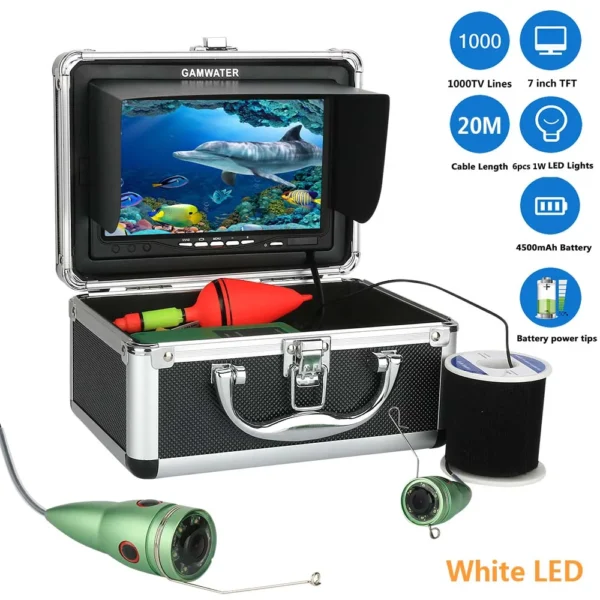
Revolutionary 7" HD Underwater Fishing Camera with LED Lights Rated 5.00 out of 5$164.55 – $208.98Price range: $164.55 through $208.98

Product Gallery
-
 Ultimate 2-3 Person Inflatable Kayak for Fishing Fun Rated 5.00 out of 5
$1,552.46Original price was: $1,552.46.$1,082.01Current price is: $1,082.01. -
VEVOR 550 lb Heavy-Duty Folding Wagon & Bench for Adventurers
$156.12 – $253.79Price range: $156.12 through $253.79
-
Adventure-Ready Ultra Bright LED Headlamp with 3 Modes
$4.67 – $25.16Price range: $4.67 through $25.16


 Camping Gear
 Camping Chair
 Camping Table
 Sleeping Bags
 Camping Bed
 Sleeping Gear
 Storage Bags
 BBQ Portable
 Camping Tents
 Gazebos
 Outdoor Cooler
 Cookware
 Power
Power Camping Light
 Flashlight
 Portable Solar
 Power Banks
 Fish Finders
 Fishing Bags
 Fishing Jerseys
 Fishing Reels
 Fishing Chairs
 Fishing Bait Boat
 Fishing Floats
 Hard Baits
 Hiking Vests
 Outdoor Bags
 Water Filters
 Paracord
 Walkie Talkie
 Paddleboards
 Boats
Boats Sea Scooter
 Accessories
 Electric Bike
 Electric Scooter
Recent Comments