So, you’re thinking about venturing into the great outdoors? Awesome! But before you trade Netflix for nature trails, let’s talk about something crucial: navigation. Getting lost isn’t just a minor inconvenience; it can turn a fun camping trip into a survival situation quicker than you can say “bear.” This guide is your starting point to becoming a confident navigator, ensuring your adventures are memorable for all the right reasons. Ready to get started? Let’s jump in!
Why Navigation Skills Are Non-Negotiable for Campers
Think of navigation skills like your camping superpower. You wouldn’t head into a superhero battle without your gadgets, right? Same deal here. Relying solely on technology can be a risky game. What happens when your phone battery dies, or you lose signal deep in the woods? (Spoiler alert: it will happen eventually!).
Staying Safe Out There
It’s not just about getting from point A to point B; it’s about staying safe. Good navigation skills mean you can:
- Avoid hazardous areas (like cliffs or swamps).
- Find your way back to camp if you wander off.
- Estimate how much daylight you have left (crucial for planning).
- Effectively communicate your location to rescuers in an emergency.
Yeah, it’s serious stuff. But the good news is that learning basic navigation is totally achievable, even if you think you have the directional skills of a confused squirrel. And you know what? Getting good at it is incredibly rewarding. There’s a real sense of accomplishment that comes with confidently leading your group through the wilderness. It’s empowering!
Becoming More Self-Reliant
There’s something pretty amazing about knowing you can handle yourself in the wilderness. Mastering navigation takes you from being a passive observer of nature to an active participant. You start seeing the landscape differently, noticing details you’d have missed before. You learn to read the land, understanding its subtle cues and rhythms.
Plus, let’s be real, it just feels darn good to not be constantly reliant on your phone. Ever been in a situation where your GPS is glitching out, and you’re the only one who knows how to use a map and compass? Trust me, you’ll feel like a wilderness wizard. It’s like having a secret weapon – a skill that makes you more confident, capable, and connected to the natural world.
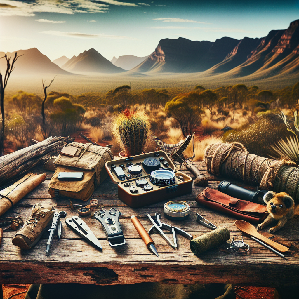
Essential Tools of the Trade: What You’ll Need in Your Pack
Okay, so you’re convinced you need some navigation skills. What’s next? Gathering the right tools. Think of it like equipping yourself for an adventure. You wouldn’t build a house without a hammer and nails, and you shouldn’t hit the trail without these essentials:
The Indispensable Map and Compass
I know, I know – it sounds a bit old-school in our digital age. But trust me, this dynamic duo is the backbone of backcountry navigation. They’re reliable, don’t need batteries, and, when used correctly, can get you out of a jam when your tech fails. Let’s break them down:
Understanding Topographic Maps
Not all maps are created equal. A topographic map (or “topo” map) is a detailed representation of the Earth’s surface, showing not only roads and trails but also natural features like elevation changes, rivers, and forests. See, these maps use contour lines to show elevation. The closer the lines, the steeper the terrain. It’s like reading the wrinkles on the face of the Earth—each line tells a story about the land’s shape.
When choosing a map, make sure it covers the area you’ll be camping in and is relatively up-to-date. Land changes over time (new trails get built, old ones get overgrown, etc.), so an outdated map can lead you astray.
Choosing the Right Compass: Features to Look For
A compass isn’t just a needle pointing north. A good camping compass should have:
- A baseplate: This clear plastic plate allows you to lay the compass flat on the map and take accurate bearings.
- A rotating bezel: This outer ring is marked with degrees (0-360) and is used to set your bearing.
- A magnetic needle: The part that points to magnetic north. Make sure it’s liquid-filled for smoother movement and accuracy.
- Declination adjustment: We’ll talk about declination later, but this feature allows you to correct for the difference between magnetic north and true north (crucial for accurate navigation).
Brands like Suunto and Silva are known for quality compasses, but there are plenty of other reliable options out there. Look for a compass that feels comfortable in your hand and has easy-to-read markings.
GPS Devices: High-Tech Help (But Don’t Rely *Too* Much!)
GPS devices (like handheld units or smartphone apps) can be incredibly useful for camping navigation. They can pinpoint your location, track your route, and even provide pre-loaded maps. But here’s the thing: they are *not* a substitute for map and compass skills. Treat them as a supplement, not a replacement.
Handheld GPS Units: Rugged and Reliable
Handheld GPS units are designed specifically for outdoor use. They’re typically more rugged and water-resistant than smartphones, and they often have better battery life. Many also have features like barometric altimeters (to measure elevation) and electronic compasses.
Smartphone Apps: Convenience at Your Fingertips
There are tons of great navigation apps for smartphones, like Gaia GPS, AllTrails, and Backcountry Navigator. They’re convenient because you’re already carrying your phone anyway. But be aware of the limitations: battery life, signal dependency, and fragility. Always bring a power bank and consider downloading offline maps before you head out.
Other Helpful Gadgets and Accessories
Beyond the map, compass, and GPS, there are a few other things that can make your navigation life easier:
- Altimeter watch: Tracks your altitude, which can be helpful for confirming your location on a topo map. It is useful if you do not have handheld GPS units.
- Binoculars: For scouting terrain features and landmarks from a distance.
- Headlamp or flashlight: Essential for navigating in the dark. Look for one with a red-light mode to preserve your night vision.
- Whistle: For signaling for help if you get lost. The standard signal is three short blasts.
- Mirror: Like the whistle, helps signalling in a rescue scenario.
- Notebook and pencil: For taking notes, sketching maps, and recording waypoints.
Putting together your navigation kit is like assembling your team of trusty sidekicks. Each tool has its own strengths, and when used together, they’ll help you conquer any navigational challenge the wilderness throws your way.
Mastering the Basics: Essential Navigation Skills for Campers
Alright, gear in hand, let’s get down to the nitty-gritty: the skills you need to navigate like a pro. It’s not about being a cartography expert, but rather about being competent and confident in your abilities to find your way. You’ll be surprised how quickly you pick these up. So, let’s start with the fundamentals.
Understanding Map Symbols and Topographic Features
A map is essentially a language, and the symbols are its alphabet. Understanding these symbols is crucial for “reading” the map and understanding the terrain it represents. Common symbols include:
- Roads: Usually depicted as lines, with different colors or widths indicating the type of road (highway, dirt road, etc.).
- Trails: Similar to roads, but often shown as dashed lines or with specific trail markers.
- Rivers and streams: Shown as blue lines, with wider lines indicating larger bodies of water.
- Buildings: Usually represented as small squares or rectangles.
- Contour lines: The most important feature on a topo map, showing elevation changes. Remember, close lines mean steep terrain, while widely spaced lines mean gentle slopes.
Seriously, take some time to familiarize yourself with these symbols. Most maps have a legend (a key) that explains what each symbol represents. Treat the legend as your Rosetta Stone to decoding the landscape.
Orienting Your Map: Aligning with the Real World
Orienting your map means aligning it with the terrain around you. This is a fundamental skill that helps you visualize the map in relation to the real world. Here’s how to do it:
- Find your location on the map: Use landmarks, trail intersections, or GPS coordinates to pinpoint your position.
- Place your compass on the map: Lay the compass flat on the map.
- Rotate the map: Turn the map until the north end of the compass needle points to the north arrow on the map.
Once the map is oriented, you can easily identify landmarks and terrain features around you, and relate them to the map.
Taking a Bearing: Finding Your Direction
Taking a bearing is the process of determining the direction from your current location to a specific point (like a landmark or your destination). Here’s how it works:
- Identify your target: Choose a visible landmark or your destination.
- Point the direction-of-travel arrow on your compass at the target: Hold the compass flat in your hand and point the arrow towards the landmark You know what? It’s a lot easier than it sounds!
- Rotate the bezel: Turn the rotating bezel until the north end of the compass needle lines up with the orienting arrow on the compass housing.
- Read the bearing: The bearing is the number on the bezel that lines up with the direction-of-travel arrow. This is the angle you need to follow to reach your target.
Once you have your bearing, follow it by using the compass to stay on course. Keep the compass needle aligned with the orienting arrow as you walk. If you veer off course, adjust your direction accordingly.
Understanding Declination: True North vs. Magnetic North
Okay, this is where things can get a little confusing, but stick with me. Magnetic north (where your compass needle points) is not the same as true north (the geographic North Pole). The difference between the two is called declination, and it varies depending on your location on Earth.
If you don’t account for declination, you could end up significantly off course, especially over long distances. Here’s how to deal with it:
- Find the declination for your area: You can find this information on your topo map or online.
- Adjust your compass (if possible): Many compasses have a declination adjustment screw that allows you to compensate for the difference between true north and magnetic north.
- Calculate the correction manually: If your compass doesn’t have declination adjustment, you’ll need to add or subtract the declination value from your bearing. The map legend will tell you whether to add or subtract, based on whether you are on the east or west side of the agonic line (where declination is zero).
Triangulation: Pinpointing Your Exact Location
Let’s say you’re not sure exactly where you are on the map. Triangulation can help. It involves taking bearings to two or three visible landmarks and then using those bearings to pinpoint your location on the map.
- Identify two or three landmarks: Choose distinct features that you can easily identify on the map (like mountain peaks or trail intersections).
- Take a bearing to each landmark: Use your compass to determine the bearing to each landmark.
- Convert the bearings to back bearings: A back bearing is the opposite direction of your bearing. To calculate it, add 180 degrees to your bearing (if it’s less than 180 degrees) or subtract 180 degrees (if it’s more than 180 degrees).
- Draw lines on the map: Use a straightedge to draw a line along each back bearing, starting from the landmark. The point where the lines intersect is your approximate location.
Like any skill, triangulation takes practice. But it’s a valuable technique for confirming your position and getting back on track if you’re unsure of your location.
Planning Your Route: From Home to Campsite Like a Pro
So, you’ve got the gear and the skills. Now it’s time to put it all together and plan your camping route. Think of this as designing your own adventure. A well-planned route not only makes your trip safer but also allows you to fully appreciate the journey.
Studying Your Route: Know Before You Go
Before you even pack your bag, spend some quality time with your map. Examine the terrain, identify potential hazards, and familiarize yourself with the landmarks along the way. Remember, knowledge is power. The more you know about your route before you set foot on the trail, the better prepared you’ll be for anything that comes your way.
Identifying Potential Hazards and Challenges
Every camping route comes with its own set of challenges. Maybe it’s a steep climb, a river crossing, or an area known for bear activity. Identifying these potential hazards in advance allows you to plan accordingly. Can you deal with some of these dangers with awareness, proper gear, and caution?
Setting Realistic Daily Goals
It’s tempting to try to cram as much mileage as possible into each day, but that’s a recipe for exhaustion and potential injury. Be realistic about how far you can hike each day, taking into account the terrain, your fitness level, and the amount of daylight you have. It’s always better to arrive at camp early and relaxed than to be pushing yourself to the limit in the dark.
Creating a Detailed Itinerary
A detailed itinerary outlines your daily plan, including:
- Your starting point and destination for each day.
- The estimated mileage and elevation gain.
- Potential campsites along the way.
- Water sources.
- Emergency exit routes.
Share this itinerary with someone reliable back home, and let them know when you expect to be back. That way, if something goes wrong, they can alert the authorities and provide them with valuable information about your planned route.
Navigating in Different Environments: Woods, Mountains, and Beyond
The skills you need to navigate effectively can vary depending on the type of environment you’re in. Navigating in a dense forest is different from navigating in open mountains, and both present unique challenges. Here’s a quick guide to navigating in different environments:
Dense Woods and Forests: Using Linear Features
In dense woods, visibility is often limited, making it difficult to see landmarks from a distance. Instead, focus on using linear features like trails, streams, and ridgelines to guide you. Stick to known trails whenever possible, and pay close attention to trail markers. If you have to navigate off-trail, use your compass to maintain your bearing and be prepared to bushwhack.
Open Mountains: Leveraging Visibility and Terrain
In open mountains, you typically have far greater visibility, allowing you to see landmarks from miles away. Use these landmarks to your advantage, taking bearings to distant peaks and ridges to stay on course. Be aware of the effects of weather on visibility. Fog, snow, and rain can quickly obscure landmarks, making navigation much more challenging. Make sure your gear is working well to improve visibility.
Navigating in Low-Visibility Conditions
Fog, snow, and rain can make navigation incredibly difficult, even for experienced campers. When visibility is limited, here’s what to do:
- Slow down: Don’t try to rush. Take your time and pay close attention to your surroundings.
- Use your compass: Rely on your compass to maintain your bearing.
- Follow linear features: Stick to trails, streams, or ridgelines whenever possible.
- Listen: Sound can be a valuable navigation tool in low visibility. Listen for the sound of running water, wind, or other campers.
- Stay put if necessary: If visibility is so poor that you can’t see more than a few feet in front of you, it’s often best to stay put and wait for conditions to improve.
Remember, the key to navigating in any environment is to be adaptable, observant, and cautious. Be prepared for changing conditions, and don’t be afraid to adjust your route or your plans if necessary.
Emergency Navigation Techniques: When Things Go Wrong
No matter how well you plan, things can sometimes go wrong, and in an emergency situation, your navigation skills can be the difference between life and death. Here are a few emergency navigation techniques to keep in mind:
What to Do If You Get Lost: Stay Calm and Assess
The first thing to do if you realize you’re lost is to stay calm. Panic will only cloud your judgment and make it harder to think clearly. Take a deep breath, sit down, and assess the situation. Ask yourself:
- When did I last know my location?
- Which direction was I traveling?
- Have I seen any landmarks recently?
Using Natural Navigation: The Sun, Moon, and Stars
Even without a map and compass, you can use natural features to get a sense of direction. During the day, the sun rises in the east and sets in the west. At night, you can use the North Star (Polaris) to find north. Look for the Big Dipper constellation, then follow the two stars that form the end of the “cup” upwards. They’ll point you directly to Polaris.
Building a Fire as a Signal: Attracting Attention
A fire can be a powerful signal, especially at night. Build a large fire in an open area, and add green vegetation to create smoke. The international distress signal is three fires built in a triangle.
Signaling for Help: Whistles, Mirrors, and More
In an emergency, signaling for help is crucial. Carry a whistle and a mirror in your survival kit. Three short blasts on a whistle is the universal distress signal. A mirror can be used to reflect sunlight over long distances, attracting the attention of aircraft or rescuers.
Emergency situations are never fun, but being prepared and knowing how to use your navigation skills can significantly increase your chances of survival. Stay calm, think clearly, and never give up hope!
Practice Makes Perfect: Honing Your Navigation Skills
You know what they say – practice makes perfect! When it comes to navigation, this couldn’t be truer. You can read all the books and articles you want, but the only way to truly master these skills is to get out there and use them. The more you practice, the more confident and competent you’ll become.
Start Small: Practice in Familiar Areas
Don’t try to tackle a challenging backcountry route right away. Start small by practicing your navigation skills in familiar areas, like local parks or hiking trails. Use a map and compass to navigate even on well-marked trails. Take bearings to landmarks, orient your map, and estimate distances.
Participate in Orienteering Events
Orienteering is a sport that combines navigation with running or hiking. Participants use a map and compass to find a series of checkpoints in the wilderness. Orienteering events are a great way to practice your navigation skills in a fun and challenging environment. Plus, you’ll meet other like-minded outdoor enthusiasts.
Create Your Own Navigation Challenges
Get creative and design your own navigation challenges. Hide objects in the woods and use a map and compass to find them. Plan a route that involves multiple bearings and distance calculations. The possibilities are endless!
The more you practice your navigation skills, the more they’ll become second nature. Soon, you’ll be able to navigate with confidence in any environment, knowing that you have the skills and knowledge to find your way.
Advanced Techniques: Taking Your Skills to the Next Level
For those who want to take their navigation skills to the next level, there are a few advanced techniques to explore. These techniques require a deeper understanding of map reading, compass work, and terrain analysis.
Micro-navigation: Reading the Fine Details
Micro-navigation involves paying close attention to the small details of the terrain to guide your route. This might include following subtle changes in elevation, identifying small streams or gullies, or using vegetation patterns to stay on course. Micro-navigation is particularly useful in dense forests or areas with limited visibility.
Navigation by Terrain Association
Terrain association involves using your knowledge of the terrain to anticipate what you’ll find around the next bend. This requires a deep understanding of how landforms are created and how they relate to each other. With practice, you can learn to “read” the landscape and predict where you’ll find water sources, campsites, and other important features.
Night Navigation: Finding Your Way in the Dark
Navigating at night presents unique challenges. Visibility is limited, and landmarks can be difficult to identify. To navigate effectively at night, focus on using your compass and following linear features. Use a headlamp with a red-light mode to preserve your night vision. And always be extra cautious, as hazards can be more difficult to spot in the dark.
These advanced techniques require time, patience, and dedicated practice. But with enough effort, you can master these skills and become a true backcountry navigation expert.
Staying Safe: Navigation and Camp Security Best Practices
Camping isn’t just about navigation; it’s also about staying safe and secure. A well-navigated campsite is a secure campsite. Here are some best practices to keep in mind:
Choosing a Safe Campsite: Location, Location, Location
When selecting a campsite, consider the following factors:
- Avoid floodplains: Camp at least 200 feet away from rivers and streams to avoid being flooded in case of heavy rain.
- Look for flat ground: Choose a level area to pitch your tent.
- Be aware of overhead hazards: Avoid camping under dead trees or branches that could fall in strong winds.
- Consider wind direction: Position your tent so that the wind is at your back.
Establishing a Camp Perimeter: Keeping Critters at Bay
Create a clear perimeter around your campsite to discourage animals from approaching. This might involve clearing away brush and debris, creating a visual barrier with rocks or logs, or hanging food from a tree (at least 10 feet off the ground and 4 feet from the trunk).
Responsible Campfire Practices: Safety First
If you’re planning to have a campfire, follow these safety guidelines:
- Check for fire restrictions: Make sure campfires are allowed in the area you’re camping in.
- Build your fire in a designated fire pit or ring: Clear away any flammable material within a 10-foot radius.
- Never leave your fire unattended: Keep a bucket of water and a shovel nearby in case of emergencies.
- Extinguish your fire completely before leaving: Pour water on the embers until they’re cool to the touch.
Bear Safety: Storing Food Properly
If you’re camping in bear country, take extra precautions to protect yourself and your food. Here are a few tips:
- Store food in bear-resistant containers: These containers are designed to prevent bears from accessing your food.
- Hang your food from a tree: If you don’t have bear-resistant containers, hang your food in a bear bag, at least 10 feet off the ground and 4 feet from the trunk.
- Never leave food unattended: Bears are attracted to the smell of food. Never leave food out in the open, even for a few minutes.
By following these navigation and camp security best practices, you can minimize your risk of accidents and injuries and enjoy a safe and memorable camping experience.
FAQ Section
Honestly, it’s gotta be a good old map and compass. Batteries don’t die, and they work even without cell service!
Make sure the map covers the specific area you’ll be exploring, and check that it’s relatively recent. Land changes, you know?
I wouldn’t advise it. Smartphones are great supplements, but they’re not as reliable as a map and compass. Plus, battery life can be a real issue.
Start small! Practice in familiar areas like local parks, and gradually increase the difficulty as you get more confident.
Find the declination for your area on your map or online, then adjust your compass accordingly. Some compasses have a built-in adjustment, but if not, you’ll need to do some math.
First, stay calm! Then, try to retrace your steps or use landmarks to figure out where you went wrong. If all else fails, signal for help and stay put.
Absolutely! Look for local orienteering clubs or outdoor skills workshops in your area. You can also find tons of great online resources, including videos and articles from reputable organizations.
DISCLAIMER
Camping and outdoor activities involve inherent risks. While this guide provides information on navigation and safety, it’s essential to gain practical experience and training before venturing into the wilderness. Always check weather conditions, inform someone of your plans, and carry appropriate safety gear. The author and publisher are not responsible for any accidents, injuries, or damages that may occur as a result of using this information.
Categories
- Navigation & Safety (68)
- Shelter & Sleep (72)
Top rated products
-
 UNIKOO UK224 Mini Walkie Talkies: Adventure Awaits, Stay Connected! Rated 5.00 out of 5
$49.74Original price was: $49.74.$34.67Current price is: $34.67. -
Nature Bell 185 cm Folding Cot: Comfort On-the-Go Adventure Bed Rated 5.00 out of 5$35.61 – $37.99Price range: $35.61 through $37.99
-
Tactical Mini Flashlight: 150 Lumen Power for Glock & Hellcat Rated 5.00 out of 5
$122.88Original price was: $122.88.$85.65Current price is: $85.65.


Product Gallery
-
 Ultimate 2-3 Person Inflatable Kayak for Fishing Fun Rated 5.00 out of 5
$1,534.01Original price was: $1,534.01.$1,069.16Current price is: $1,069.16. -
VEVOR 550 lb Heavy-Duty Folding Wagon & Bench for Adventurers
$154.27 – $250.78Price range: $154.27 through $250.78
-
Adventure-Ready Ultra Bright LED Headlamp with 3 Modes
$4.62 – $24.86Price range: $4.62 through $24.86


 Camping Gear
 Camping Chair
 Camping Table
 Sleeping Bags
 Camping Bed
 Sleeping Gear
 Storage Bags
 BBQ Portable
 Camping Tents
 Gazebos
 Outdoor Cooler
 Cookware
 Power
Power Camping Light
 Flashlight
 Portable Solar
 Power Banks
 Fish Finders
 Fishing Bags
 Fishing Jerseys
 Fishing Reels
 Fishing Chairs
 Fishing Bait Boat
 Fishing Floats
 Hard Baits
 Hiking Vests
 Outdoor Bags
 Water Filters
 Paracord
 Walkie Talkie
 Paddleboards
 Boats
Boats Sea Scooter
 Accessories
 Electric Bike
 Electric Scooter
Recent Comments