So, you’re itching to ditch the city lights for a starlit sky, eh? That’s fantastic! Camping is an amazing way to reconnect with nature and recharge your batteries. But before you venture too far off the beaten path, let’s talk navigation. Trust me, knowing how to find your way in the wilderness isn’t just about convenience; it’s about safety. And honestly, it’s a skill that’ll make you feel like a true adventurer. We’re not talking about getting hopelessly lost and snacking on pine needles – we’re talking about confident exploration! Let’s get started.
Why Navigation Skills Are Non-Negotiable for Campers
Alright, let’s cut to the chase. Why is navigation so crucial? Picture this: You’re hiking, admiring the scenery, maybe taking a few too many Instagram-worthy shots. Suddenly, the trail vanishes. The sun starts to dip, and a sense of unease creeps in. Without solid navigation skills, that idyllic camping trip can quickly turn into a survival situation. No fun, right?
See, modern tech is great, but batteries die. GPS signals can be wonky in deep canyons or dense forests. Hell, sometimes you just want to disconnect from the digital world! That’s where old-school navigation, like map and compass skills, come into play. They’re reliable, they don’t need charging, and they empower you to be self-sufficient. They’re your lifeline when things get hairy. Knowing where you are, where you’re going, and how to get back is, well, kind of important!
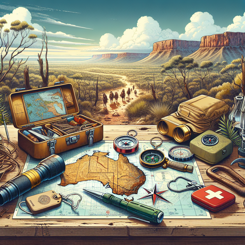
The Essential Tools of the Trade: Gear Up for Success
Okay, what tools do you need to become a navigation whiz? Don’t worry, it’s not an overwhelming list. Here’s the core kit:
- Topographic Map: This isn’t your everyday street map. Topo maps show elevation changes (hills, valleys, etc.) using contour lines. More on that in a bit! Think of it as a detailed 3D rendering of the landscape.
- Compass: A trusty compass is a must. Get one with a baseplate, a rotating bezel, and a declination adjustment. These features make it much easier to take accurate bearings. A mirrored sighting compass is a good choice for more advanced work.
- GPS Device (Optional): A handheld GPS unit can be a great backup, but don’t rely on it solely. Learn to use it in conjunction with your map and compass. Some smartwatches also have GPS functionality, but keep in mind battery life is often a concern.
- Altimeter (Optional): An altimeter measures altitude, which can help you pinpoint your location on a topo map. Some GPS units have built-in altimeters. It works by measuring barometric pressure – the higher you go, the lower the pressure. Pretty neat, huh?
- Navigation Apps for Your Smartphone (Optional): Okay, I know I said don’t rely on tech, but a navigation app like Gaia GPS or CalTopo can be incredibly useful– if you know how to use it correctly. They can provide detailed maps, track your route, and even download maps for offline use (critical!). But here’s the thing: treat them as a supplement, not a replacement, for traditional navigation skills.
- Pencil and Paper: For jotting down notes, bearings, and other important info. A waterproof notebook is a good idea! Remember, technology can fail – but a pencil and paper? Reliable as heck.
Don’t skimp on quality, especially when it comes to your compass and map. Invest in gear that is robust and reliable. A cheap compass that breaks in the middle of nowhere is about as useful as a chocolate teapot.
Understanding Topographic Maps: Decoding the Landscape
Alright, let’s talk topo maps – your window into the wilderness. These maps are packed with information, but once you learn to decipher them, they become an invaluable tool. It’s like learning a new language, but instead of words, you’re reading the land itself. You know what? One thing that scares people off maps is all the information. Let me break it down; it is simpler than you think.
Here are the key elements to wrap your head around:
- Contour Lines: These are the squiggly lines that represent elevation. Each line connects points of equal altitude. The closer the lines are together, the steeper the terrain. Widely spaced lines mean a gentle slope. Think of them as cross-sections of the terrain, sliced at regular intervals.
- Contour Interval: This is the vertical distance between contour lines. It’s usually noted in the map legend (like 20 feet or 40 feet). Knowing the contour interval allows you to estimate the height of features on the map. Without it, contour lines are just squiggles!
- Map Scale: This indicates the relationship between distances on the map and distances on the ground. A scale of 1:24,000 (a common USGS topo map scale) means that one inch on the map equals 24,000 inches (2,000 feet) on the ground. Understanding the scale is crucial for estimating distances. You always want to know your mileage.
- Legend: This explains all the symbols used on the map. You’ll find symbols for trails, roads, buildings, water features, vegetation, and more. Always consult the legend before hitting the trail! It’s like reading the instructions before assembling IKEA furniture!
- North Arrow: This indicates the direction of true north (the geographic North Pole). It’s important to note that true north is slightly different from magnetic north (the direction your compass needle points). This difference is called declination – we’ll get to that next.
Practice reading topo maps before your trip. Find some local topographic maps, and try to identify features you’re familiar with, like hills, rivers, and roads. The more you practice, the easier it will become to visualize the landscape in your head. Eventually, you’ll be able to look at a map and “see” the terrain as if you were standing right there.
Mastering the Compass: Your North Star in the Wilderness
The compass is your trusty guide, your constant reference point. But it’s not just about knowing which way is north. To truly master the compass, you need to understand a few key concepts:
- Magnetic Declination: Remember that true north and magnetic north aren’t the same? The difference between them is called magnetic declination. This varies depending on your location and changes over time. You need to adjust your compass for declination to get accurate bearings. Most compasses have an adjustable declination, follow the manufacturer’s instructions.
- Taking a Bearing: This involves sighting a distant object (like a mountain peak or a prominent tree) and determining its compass bearing (the angle in degrees between north and the object). To take a bearing, hold the compass level in front of you, point the direction-of-travel arrow at the object, and rotate the bezel until the north end of the compass needle aligns with the orienting arrow on the compass housing. Read the bearing at the index line.
- Following a Bearing: Once you have a bearing, you can use it to navigate in a specific direction. Simply rotate the bezel to the desired bearing, hold the compass level, and turn your body until the north end of the compass needle aligns with the orienting arrow. Then, walk in the direction of the direction-of-travel arrow. Sounds simple, but it takes practice!
- Back Bearings: A back bearing, or reciprocal bearing, is the opposite direction of a given bearing. To calculate a back bearing, add 180 degrees to the original bearing if it’s less than 180 degrees, or subtract 180 degrees if it’s greater than 180 degrees. Back bearings are useful for retracing your steps or for confirming your location.
Practice using your compass in different types of terrain. Learn how to take bearings accurately, and how to follow them even when the terrain is uneven or obstructed. A good trick is to try navigating a course in a local park or open space. Set up a series of waypoints, take bearings to each one, and then try to navigate to them using only your compass. This will help you build confidence in your skills.
Map and Compass Skills: Working Together in Harmony
Now, here’s where the magic happens! Combining map and compass skills allows you to pinpoint your location, plan your route, and navigate with confidence. It’s like having a GPS in your head, but with a deeper understanding of the terrain around you. You are no longer relying on satellites. You are the satellite!
Here are the key steps:
- Orient the Map: This means aligning the map with the terrain. To do this, place your compass on the map, aligning the edge of the compass with the north-south grid lines on the map. Rotate the map until the north end of the compass needle points to north on the map. Now the map is aligned with the real world.
- Locate Yourself on the Map: This can be done using various techniques, such as identifying landmarks, using resection (taking bearings to two or more known landmarks), or using terrain association (matching features on the map to features on the ground) . Always note your starting point on the map. This is essential for tracking your progress.
- Plan Your Route: Use the map to identify potential hazards (steep slopes, water crossings, etc.) and to choose the safest and most efficient route. Note the bearings and distances between key waypoints along your route. A proper plan can save you energy and time.
- Follow Your Bearings: Use your compass to follow the bearings you’ve identified on the map. Regularly check your location and adjust your course as needed. Don’t be afraid to detour around obstacles, but always keep track of your position on the map.
Map and compass work is a skill that requires practice and patience. Don’t get discouraged if you don’t get it right away. Start with simple exercises in familiar terrain, and gradually work your way up to more challenging situations. The more you practice, the more intuitive it will become.
Navigation in Different Terrains and Conditions: Adapt and Overcome
The wilderness is a dynamic place, and navigation challenges can vary depending on the terrain and weather conditions. Let’s consider what you need to know.
- Forests: Dense forests can limit visibility and make it difficult to see landmarks. Use your compass to follow bearings accurately, and pay close attention to terrain features. Watch out for obstacles like fallen trees and dense undergrowth.
- Mountains: Mountainous terrain can be challenging due to steep slopes, exposed ridges, and unpredictable weather. Use contour lines to understand the terrain, and plan your route carefully. Be aware of avalanche hazards in winter. Speaking of avalanches, knowing your terrain can save your life!
- Deserts: Deserts can be disorienting due to the lack of vegetation and landmarks. Use your compass to follow bearings, and pay close attention to the sun’s position. Carry plenty of water, and be aware of heat exhaustion and dehydration.
- Bad Weather: Rain, snow, fog, and darkness can greatly reduce visibility and make navigation more difficult. If possible, avoid traveling in bad weather. If you must travel, use your compass and map carefully, and be prepared to hunker down and wait it out.
Adapt your navigation techniques to the specific conditions. In dense forests, for example, you might need to rely more on pacing and timing to estimate distances. In open terrain, you can use distant landmarks to stay on course. The key is to be flexible and resourceful.
Staying Safe: Essential Safety Tips for Navigation
Navigation isn’t just about getting from point A to point B. It’s also about staying safe. Here are some essential safety tips to keep in mind:
- Tell Someone Your Plans: Before you go, let someone know your destination, route, and expected return time. This way, if you get lost or injured, someone will know where to look for you.
- Check the Weather Forecast: Be aware of potential weather hazards, and adjust your plans accordingly. Avoid traveling in severe weather.
- Carry a First-Aid Kit: Be prepared to treat minor injuries and illnesses. Know how to use the items in your kit.
- Carry Extra Food and Water: Always bring more than you think you’ll need. You never know when you might get delayed.
- Know How to Signal for Help: Carry a whistle, a signal mirror, or a satellite communicator. Know how to use them to attract attention in an emergency. Three blasts on a whistle or three flashes with a mirror are universally recognized distress signals.
Prevention is always better than cure. Plan your trip carefully, be prepared for the unexpected, and always err on the side of caution. A little preparation can go a long way in ensuring a safe and enjoyable camping experience.
Practice Makes Perfect: Hone Your Skills Before You Go
Okay, you’ve learned the theory. Now it’s time to put it into practice! Navigation is a skill that requires hands-on experience. You can’t just read about it and expect to be an expert. Get out there and practice!
Here are some ways to hone your navigation skills:
- Practice in Familiar Terrain: Start with simple exercises in a local park or open space. Get comfortable using your map and compass before venturing into more challenging terrain.
- Take a Navigation Course: Many outdoor organizations offer navigation courses. These courses provide hands-on instruction and valuable experience.
- Join a Hiking Group: Hike with experienced navigators and learn from their expertise. A Hiking group is a great way to be prepared and network!
- Create Navigation Challenges: Set up a series of waypoints and try navigating to them using only your map and compass. Time yourself and try to improve your speed and accuracy.
- Use Online Resources: There are many online resources available to help you improve your navigation skills, including tutorials, quizzes, and interactive simulations.
The more you practice, the more confident and proficient you’ll become at navigation. Don’t be afraid to make mistakes – that’s how you learn. And remember, even experienced navigators can get lost from time to time. The key is to stay calm, assess the situation, and use your skills to find your way back. Honestly, getting “temporarily misplaced” can be a learning experience!
Tech to the Rescue?: Navigating with GPS and Digital Tools
Alright, it’s time to address the elephant in the room: GPS and other digital navigation tools. These gadgets can be incredibly useful, but they’re not a substitute for traditional navigation skills. Think of them as a helpful supplement, not a replacement. Technology can fail you! Learn the foundational skills, then let tech make them that much more simple.
Here are some pros and cons of using GPS and digital tools for navigation:
- Pros:
- Accuracy: GPS devices can provide very accurate location information.
- Ease of Use: GPS units and navigation apps are generally easy to use and can display your location on a map in real-time.
- Route Planning: Many GPS devices and apps allow you to plan and download routes to your device.
- Additional Features: Some GPS units have additional features like altimeters, barometers, and electronic compasses.
- Cons:
- Battery Dependence: GPS devices require batteries, which can run out quickly in cold weather or heavy use.
- Signal Dependence: GPS signals can be blocked by dense forests, canyons, or other obstructions.
- Reliability: GPS devices can fail due to hardware or software problems.
- Distraction: Relying too much on a GPS can distract you from paying attention to your surroundings.
If you choose to use a GPS device or navigation app, learn how to use it properly. Familiarize yourself with its features, and always carry extra batteries. Download maps for offline use, in case you lose signal. And most importantly, don’t forget your map and compass! Use your GPS as a tool to enhance your navigation skills, not to replace them.
Leave No Trace Navigation: Minimizing Your Impact
As responsible campers, it’s important to minimize our impact on the environment. Navigation plays a key role in this. After all, keeping our trails clean and beautiful is a big part of the fun. Here are some tips for Leave No Trace navigation:
- Stay on Established Trails: Walking off-trail can damage vegetation, erode soil, and disturb wildlife. Stick to established trails whenever possible.
- Avoid Cutting Switchbacks: Cutting switchbacks can cause erosion and damage the trail. Resist the temptation to take shortcuts.
- Minimize Campfire Impacts: If you build a campfire, use an existing fire ring or fire pan. Keep the fire small, and burn only dead and down wood. Be sure to completely extinguish the fire before you leave.
- Pack Out All Trash: Pack out everything you pack in, including food scraps, wrappers, and toilet paper. Leave the campsite cleaner than you found it.
- Respect Wildlife: Observe wildlife from a distance, and never feed them. Store food properly to prevent attracting animals to your campsite.
By following Leave No Trace principles, we can help protect the wilderness for future generations. And that’s something we can all be proud of, right?
Final Thoughts: Embrace the Journey, Navigate with Confidence
Camping navigation is a skill that can transform your outdoor experiences. It empowers you to explore with confidence, to venture off the beaten path, and to connect with nature in a deeper way. It’s not just about knowing how to read a map and use a compass. It’s about developing a sense of self-reliance, a respect for the environment, and a love for the wild. Remember, navigation is a journey, not a destination. Embrace the challenges, learn from your mistakes, and enjoy the adventure! You know what? I think you are ready now. Go explore!
Frequently Asked Questions (FAQ) About Camping Navigation
What’s the most important thing to learn first about camping navigation?
Honestly, it’s understanding topographic maps. Knowing how to read contour lines and identify terrain features is crucial for planning your route and staying oriented.
Can I rely solely on my smartphone for navigation?
Nope. Smartphones are great, but batteries die, and signals can be unreliable. Always carry a map and compass, and know how to use them.
How do I adjust my compass for magnetic declination?
Most compasses have an adjustable declination. Consult your compass’s instructions or a declination chart for your area to set it correctly. Not doing so can throw off your bearings!
What should I do if I get lost while camping?
First, stay calm. Assess the situation, try to retrace your steps, and use your map and compass to determine your location. If you can’t find your way back, stay put and signal for help.
Is it okay to cut switchbacks on hiking trails?
Definitely not! Cutting switchbacks damages vegetation, causes erosion, and can make the trail more difficult for others to use. Stick to the established trail.
What’s the best way to practice my navigation skills?
Start with simple exercises in a local park or open space. Use a map and compass to navigate a known route, and gradually increase the difficulty as you improve. The more you practice, the better you’ll become.
Why are topographic maps so important?
Topographic maps provide a detailed representation of the terrain, including elevation changes, water features, and vegetation. This information is critical for planning your route, assessing potential hazards, and staying oriented in the wilderness.
DISCLAIMER
The information contained in this article is for general informational purposes only. While we strive to provide accurate and up-to-date content, camping navigation can be inherently risky. Always exercise caution and common sense when navigating in the outdoors. Consult with experienced navigators or outdoor professionals for personalized guidance and training. The authors and publishers are not responsible for any accidents, injuries, or losses that may occur as a result of using the information in this article.
Categories
- Navigation & Safety (68)
- Shelter & Sleep (72)
Top rated products
-
 Compact 70 CM Fishing Rod Bag - Your Adventure Awaits! Rated 5.00 out of 5$14.20 – $18.17Price range: $14.20 through $18.17
 -
Elevate Your Fishing with C118 GPS Remote Bait Boat Rated 5.00 out of 5
$307.61Original price was: $307.61.$214.40Current price is: $214.40. -
CNSUP 12 ft Inflatable Yellow Paddle Board - Adventure Awaits! Rated 5.00 out of 5$280.24 – $479.36Price range: $280.24 through $479.36


Product Gallery
-
 Ultimate 2-3 Person Inflatable Kayak for Fishing Fun Rated 5.00 out of 5
$1,537.10Original price was: $1,537.10.$1,071.31Current price is: $1,071.31. -
VEVOR 550 lb Heavy-Duty Folding Wagon & Bench for Adventurers
$154.16 – $250.60Price range: $154.16 through $250.60
-
Adventure-Ready Ultra Bright LED Headlamp with 3 Modes
$4.63 – $21.74Price range: $4.63 through $21.74


 Camping Gear
 Camping Chair
 Camping Table
 Sleeping Bags
 Camping Bed
 Sleeping Gear
 Storage Bags
 BBQ Portable
 Camping Tents
 Gazebos
 Outdoor Cooler
 Cookware
 Power
Power Camping Light
 Flashlight
 Portable Solar
 Power Banks
 Fish Finders
 Fishing Bags
 Fishing Jerseys
 Fishing Reels
 Fishing Chairs
 Fishing Bait Boat
 Fishing Floats
 Hard Baits
 Hiking Vests
 Outdoor Bags
 Water Filters
 Paracord
 Walkie Talkie
 Paddleboards
 Boats
Boats Sea Scooter
 Accessories
 Electric Bike
 Electric Scooter
Recent Comments