
Alright, picture this: You’re deep in the woods, the sun’s starting to dip, and you realize…you’re not quite sure which way is up. Or, more importantly, which way is back to camp. Sounds like a nightmare, right? That’s where the trusty map and compass come in. These aren’t relics of a bygone era; they’re absolutely essential skills that can take you from a clueless wanderer to a confident navigator. And hey, it’s kind of empowering to know you can find your way using nothing but a piece of paper and a magnetic needle.
Why Ditch the GPS (Sometimes) and Embrace Old-School Navigation?
We live in a world of GPS-enabled everything. Phones, watches, even dog collars! So, why bother learning map and compass skills? Well, tech can fail. Batteries die, signals get lost, and suddenly, you’re relying on something that’s about as useful as a paperweight in dense forest. Knowing how to use a map and compass is your backup plan—the one that doesn’t require charging or a cell tower. Besides, there’s a certain satisfaction that comes with mastering these skills. It connects you to the land in a way a GPS just can’t.
Understanding the Basics: Maps Decoded
Maps aren’t just pretty pictures; they’re coded representations of the terrain. Here’s a breakdown of what you need to know:
- Topographic Maps: These are your go-to maps for camping and hiking. They show elevation changes using contour lines. Think of them as a 3D representation of the landscape flattened onto paper.
- Scale: This tells you the relationship between the distance on the map and the distance on the ground. A scale of 1:24,000 means that one inch on the map equals 24,000 inches (or 2,000 feet) in real life.
- Contour Lines: These lines connect points of equal elevation. The closer the lines, the steeper the terrain. Wide gaps mean a gentle slope.
- Legend: This is the key to the map, explaining all the symbols used, from roads and trails to buildings and water sources.
Honestly, spending an hour just studying a map before your trip can make a huge difference. Get familiar with the terrain, identify potential hazards, and plan your route accordingly. It’s like doing your homework before a big exam—except the stakes are way higher.
Your Trusty Sidekick: The Anatomy of a Compass
Okay, the compass. It’s more than just a needle pointing north. Let’s break down the essential parts:
- Baseplate: The clear plastic base that you lay on the map.
- Magnetic Needle: The part that always points to magnetic north. (More on that later!)
- Rotating Bezel (Compass Housing): The outer ring with degree markings (0-360).
- Orienting Arrow: This arrow is inside the rotating bezel and helps you align the compass with the map.
- Index Line (Lubber Line): The line on the baseplate that you follow when taking a bearing.
Seems like a lot, right? But trust me, once you get your hands on one and start playing around, it’ll become second nature. Think of it like learning to ride a bike—a little wobbly at first, but soon you’re cruising.
Declination: Because North Isn’t Always North
Here’s a tricky one: magnetic north versus true north. The magnetic north pole (where your compass points) isn’t the same as the geographic North Pole (the top of the world on most maps). The difference between the two is called declination, and it varies depending on where you are on the planet. Failing to account for declination can throw you off course—sometimes by a significant amount. It’s like thinking you’re heading to grandma’s house, only to end up at your weird uncle’s place across town instead. Check out NOAA’s geomagnetic field calculators to learn more about declination.
You know what? Some compasses have adjustable declination settings, allowing you to compensate for this difference. If yours does, learn how to use it! If not, you’ll need to manually add or subtract the declination angle when taking bearings.
Taking a Bearing: Finding Your Way in the Wilderness
Okay, time for the main event: taking a bearing. This is how you use your map and compass together to determine the direction to a specific point.
- Orient the Map: Place your map on a flat surface and rotate it until north on the map aligns with north on your compass. You’ll use your compass to do this.
- Identify Your Location and Destination: Find your current location on the map and the point you want to reach.
- Place the Compass: Lay the compass on the map with the edge of the baseplate connecting your current location and your destination.
- Rotate the Bezel: Turn the rotating bezel until the orienting arrow lines up with magnetic north on the map. Make sure the “N” on the bezel is pointing towards north on the map.
- Account for Declination: Add or subtract the declination angle (depending on whether it’s east or west declination).
- Follow the Bearing: Remove the compass from the map and hold it in front of you. Rotate your body until the magnetic needle lines up with the orienting arrow. The direction of travel arrow on the baseplate now points towards your destination.
Easy peasy, right? Well, it takes practice. But with a little patience, you’ll be navigating like a pro. Think of it like learning a new dance move—awkward at first, but graceful with repetition.
Following a Bearing: Staying on Course
Taking a bearing is only half the battle. You also need to be able to follow that bearing in the real world. Here’s how:
- Choose a Landmark: Look ahead in the direction of your bearing and identify a prominent landmark – a tree, a rock, whatever.
- Walk to the Landmark: Head towards that landmark, keeping your eye on the compass to ensure you’re staying on course.
- Repeat: Once you reach the landmark, take another bearing to another landmark, and continue the process until you reach your destination.
This is where things can get tricky. The terrain might not be perfectly clear, or you might encounter obstacles. Be prepared to make adjustments and trust your instincts. It’s kind of like driving – you’re constantly making small corrections to stay in your lane.
Orienteering: Putting It All Together
Orienteering is a sport that combines navigation with running or hiking. It’s a great way to practice your map and compass skills in a fun and challenging environment. Think of it as a treasure hunt for adults—except the treasure is a series of checkpoints hidden in the woods.
Honestly, even just participating in a local orienteering event can dramatically improve your skills. You’ll learn to read terrain, make quick decisions, and stay oriented in challenging conditions. Plus, it’s a great workout!
Advanced Techniques: Taking Your Skills to the Next Level
Once you’ve mastered the basics, you can start exploring more advanced techniques:
- Resection: This involves using bearings to two or more known landmarks to determine your current location on the map. It’s like triangulation in geometry.
- Intersection: This involves using bearings from two known locations to determine the location of an unknown point.
- Terrain Association: This involves using the features of the landscape (hills, valleys, rivers) to help you navigate, even without a compass. It’s about developing a “feel” for the land.
These techniques require practice and a good understanding of the terrain, but they can be invaluable in challenging situations. Think of it like leveling up in a video game—you’re gaining new abilities and becoming a more skilled player.
Essential Gear: Setting Yourself Up for Success
Besides a map and compass, there are a few other items that can make your navigation efforts easier and more effective:
- Pencil and Paper: For taking notes, marking your map, and calculating bearings.
- Ruler or Protractor: For measuring distances and angles on the map.
- GPS (with Extra Batteries): As a backup, and for verifying your location.
- Altimeter Watch: This measures altitude, which can be helpful for identifying your location and tracking your progress.
Remember, gear is just a tool. The most important thing is to develop the skills and knowledge to use it effectively. It’s like having a fancy kitchen – it doesn’t make you a chef, but it can help you cook amazing meals if you know what you’re doing.
Practicing Your Skills: From Backyard to Backcountry
Don’t wait until you’re lost in the woods to practice your map and compass skills. Start in your backyard, a local park, or a familiar hiking trail. The more you practice, the more confident you’ll become. It’s like learning a new language—immersion is the key.
Honestly, even just spending a few minutes each week practicing your skills can make a big difference. Try setting up a simple orienteering course in your backyard or going for a hike and navigating using only your map and compass. The more you challenge yourself, the faster you’ll learn.
You know what? Print out sections of topographic maps and use them to navigate urban areas. It’s surprisingly fun and you can grab a coffee when you nail a difficult route.
Safety First: Staying Safe in the Wilderness
Navigation is an important part of staying safe in the wilderness. Here are a few other tips to keep in mind:
- Tell Someone Your Plans: Let a friend or family member know where you’re going and when you expect to be back.
- Check the Weather: Be aware of the forecast and be prepared for changing conditions.
- Carry a First-Aid Kit: And know how to use it!
- Bring Plenty of Food and Water: You never know when you might get delayed.
- Be Aware of Wildlife: Know how to avoid encounters with dangerous animals.
The wilderness can be a beautiful and rewarding place, but it can also be dangerous. By taking the time to prepare and learn essential skills, you can minimize the risks and enjoy your time in nature.
Remember the saying “safety first,” and you’re golden.
Common Mistakes: What Not to Do
Everyone makes mistakes, especially when they’re learning something new. Here are a few common map and compass mistakes to avoid:
- Not Accounting for Declination: This is a big one! Always remember to adjust your bearings for declination.
- Misreading Contour Lines: Pay close attention to the spacing of contour lines to understand the steepness of the terrain.
- Not Orienting the Map Correctly: Make sure your map is properly oriented before taking a bearing.
- Relying Too Much on GPS: Don’t become overly dependent on technology. Always have a backup plan.
The best way to avoid these mistakes is to practice, practice, practice! And don’t be afraid to ask for help if you’re struggling.
Honestly, those who ask, learn much faster, and remember that.
The Joy of Self-Reliance: Why It’s Worth the Effort
Learning map and compass skills isn’t just about avoiding getting lost. It’s about gaining a sense of self-reliance and confidence. It’s about connecting with nature on a deeper level and appreciating the beauty of the world around us.
You know what? There’s something incredibly empowering about knowing you can navigate using your own skills and knowledge. It’s a reminder that you’re capable of more than you think. Plus, it’s a great way to impress your friends on the trail!
Isn’t the world grand when you know you can take it on? It sure is!
Map and Compass vs. GPS: A Balanced Perspective
Let’s be clear: GPS devices are amazing tools. They can provide incredibly accurate location information and make navigation much easier. However, they shouldn’t be a substitute for map and compass skills. A GPS is a great supplement, but a map and compass is a fundamental skill. It’s like having a calculator versus understanding basic math—one enhances, the other empowers. Consider the compass a vital backup to any GPS tracking device you have. Check with the National Parks Service for current trail conditions and safety guidelines.
Here’s the thing: a GPS can fail, but the laws of physics regarding magnetic north are pretty consistent. Knowing both is the optimal strategy. GPS units are also quite expensive, so if you are someone who is not an advanced camper, there is simply no need for it yet.
Seasonal Considerations: Adapting Your Navigation Strategy
Navigation isn’t just about maps and compasses; it’s also about understanding the environment around you, which changes with the seasons. In winter, snow can obscure trails and landmarks. In spring, rivers can swell and become impassable. And in the summer, dense foliage can make it difficult to see the terrain. Adjust your navigation strategy accordingly.
For example, in winter, you might need to rely more on terrain association and track your progress more carefully to avoid getting disoriented. In the summer, you might need to use a compass more frequently to navigate through dense vegetation. Always check local weather conditions as well as for any closures.
Cultivating a Navigator’s Mindset
Becoming a skilled navigator is about more than just learning techniques; it’s about cultivating a specific mindset. This involves developing your observational skills, your spatial reasoning abilities, and your ability to make decisions under pressure. It’s like learning to play chess: you need to think several moves ahead and anticipate potential challenges. Learn to check and double check your steps, and always ensure you consider all the possible risks that may arise.
Start by paying attention to the details of your surroundings – the shape of the trees, the direction of the wind, the sound of the water. The more you observe, the better you’ll become at understanding the landscape and navigating your surroundings.
FAQ: Your Burning Questions Answered
DISCLAIMER
Please note that while this guide provides comprehensive information on map and compass skills, it should not be considered a substitute for professional training or experience. Outdoor navigation can be dangerous, and it’s essential to take appropriate precautions to ensure your safety. Always assess your skills of fitness before undertaking any outdoor activity, and consult with experienced guides or instructors if you have any questions or concerns. The author and publisher are not responsible for any accidents, injuries, or damages that may occur as a result of using the information in this guide. Also, practice navigation in safe areas first.
Categories
- Navigation & Safety (68)
- Shelter & Sleep (72)
Top rated products
-
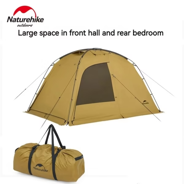
 Dune 7.6 Ultralight 2-Person Tent for All-Season Adventures Rated 5.00 out of 5$113.63 – $120.74Price range: $113.63 through $120.74
 -
Nature Bell 185 cm Folding Cot: Comfort On-the-Go Adventure Bed Rated 5.00 out of 5$36.04 – $38.44Price range: $36.04 through $38.44
-
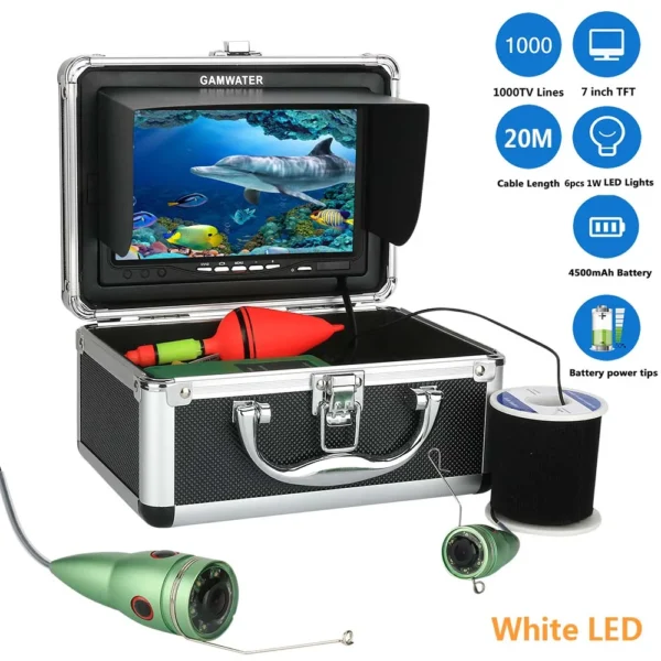
Revolutionary 7" HD Underwater Fishing Camera with LED Lights Rated 5.00 out of 5$164.55 – $208.98Price range: $164.55 through $208.98

Product Gallery
-
 Ultimate 2-3 Person Inflatable Kayak for Fishing Fun Rated 5.00 out of 5
$1,552.46Original price was: $1,552.46.$1,082.01Current price is: $1,082.01. -
VEVOR 550 lb Heavy-Duty Folding Wagon & Bench for Adventurers
$156.12 – $253.79Price range: $156.12 through $253.79
-
Adventure-Ready Ultra Bright LED Headlamp with 3 Modes
$4.67 – $25.16Price range: $4.67 through $25.16


 Camping Gear
 Camping Chair
 Camping Table
 Sleeping Bags
 Camping Bed
 Sleeping Gear
 Storage Bags
 BBQ Portable
 Camping Tents
 Gazebos
 Outdoor Cooler
 Cookware
 Power
Power Camping Light
 Flashlight
 Portable Solar
 Power Banks
 Fish Finders
 Fishing Bags
 Fishing Jerseys
 Fishing Reels
 Fishing Chairs
 Fishing Bait Boat
 Fishing Floats
 Hard Baits
 Hiking Vests
 Outdoor Bags
 Water Filters
 Paracord
 Walkie Talkie
 Paddleboards
 Boats
Boats Sea Scooter
 Accessories
 Electric Bike
 Electric Scooter
Recent Comments