Peace of Mind in the Outdoors: Mastering Map and Compass for Camping Trips
Venturing into the great outdoors is an adventure, a chance to reconnect with nature, challenge yourself, and create lasting memories. But let’s be real – it can also be a little daunting. One of the most crucial skills you can master for safe and enjoyable camping trips? Navigation. And no, I’m not just talking about relying on your smartphone. I’m talking about the timeless, reliable art of using a map and compass.
Why Map and Compass Skills Still Matter
You know, we live in a digital age where GPS devices and smartphones are practically glued to our hands. So, why bother learning how to use a map and compass? Because technology can fail. Batteries die, signals get lost, and devices break. When you’re miles from civilization, a dead phone can quickly turn an awesome adventure into a stressful situation.
Besides the reliability factor, understanding maps and compasses deepens your connection to the landscape. You’re not just following a blue dot; you’re reading the terrain, understanding elevation changes, and truly appreciating the lay of the land. It’s like learning a new language – the language of the wilderness.
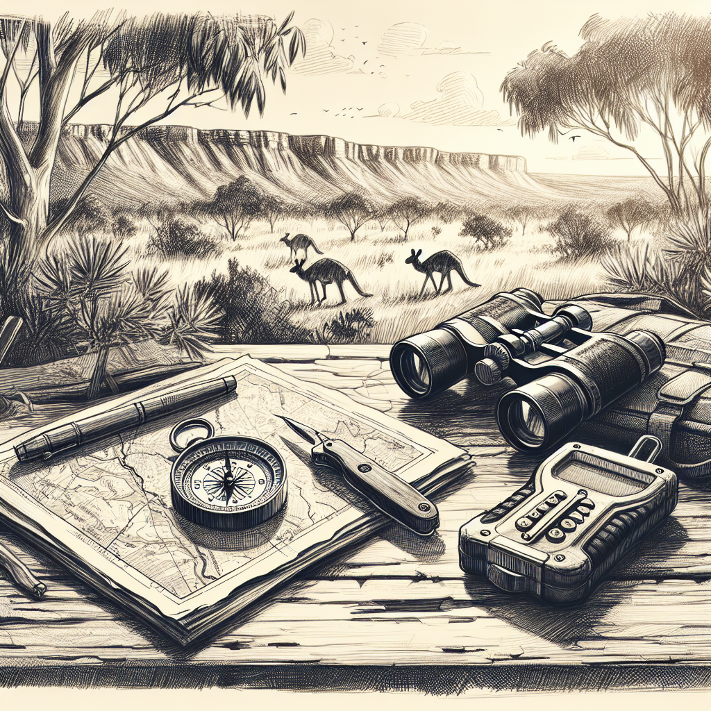
Understanding the Anatomy of a Compass
So, let’s get down to brass tacks. A compass isn’t just a needle pointing north. It’s a precision instrument with several key components:
- Baseplate: The clear plastic platform upon which everything else sits. It allows you to lay the compass flat on a map and take bearings.
- Magnetic Needle: The part that spins and aligns with the Earth’s magnetic field. Usually, the north end is colored red or black.
- Rotating Bezel (Compass Housing): The outer ring that you can turn. It’s marked with degrees (0-360) and often cardinal directions (N, S, E, W).
- Orienting Arrow: This is a fixed arrow inside the compass housing that you align with the north lines on your map.
- Index Line/Lubber Line: A fixed line on the baseplate that you read your bearing from.
- Declination Adjustment (Optional but Highly Recommended): Some compasses have a declination adjustment, which allows you to compensate for the difference between magnetic north and true north (more on that later!).
Choosing the right compass is essential, and there are a few brands that consistently deliver quality. Suunto and Silva are two names that frequently come up. They offer a range of compasses from basic models perfect for beginners to advanced options with features like global needles and sighting mirrors for more precise bearings.
De-Coding Topographic Maps: Your Land Navigation Blueprint
A topographic (topo) map is a two-dimensional representation of a three-dimensional landscape. Topo maps use contour lines to show elevation changes, making it possible to visualize the terrain. It might seem intimidating at first, but once you understand the basics, you’ll be reading the landscape like a pro.
- Contour Lines: These are the squiggly lines that connect points of equal elevation. The closer the lines are together, the steeper the terrain. Widely spaced lines indicate gentle slopes.
- Contour Interval: The difference in elevation between adjacent contour lines. This is usually noted on the map legend.
- Legend: The key to understanding the symbols and colors used on the map. It tells you what everything represents, from trails and roads to forests and water features.
- Scale: The ratio between the distance on the map and the corresponding distance on the ground. For example, a scale of 1:24,000 means that one inch on the map equals 24,000 inches (2,000 feet) on the ground.
- North Arrow: Indicates the direction of true north and magnetic north (and the declination angle between them!).
So, how do you actually *use* this information? Let’s say you see a bunch of tightly packed contour lines. That tells you, “Hey, there’s a steep hill here. Maybe find a different route!” Or if you’re looking for a campsite near water, you’ll look for blue lines or shapes indicating rivers, streams, or lakes.
Taking a Bearing: Finding Your Direction
Taking a bearing is the process of determining the direction from your current location to a specific point. It’s like setting your course. Here’s how to do it:
- Orient the Map: Place your map on a flat surface and use your compass to align it with true north. Rotate the map until the north arrow on the map points in the same direction as the north end of your compass needle (adjusting for declination, of course!).
- Identify Your Location and Destination: Locate your current position on the map and the point you want to reach.
- Place the Compass: Lay the edge of the compass baseplate on the map so that it connects your current location and your destination.
- Rotate the Bezel: Turn the compass bezel until the orienting arrow on the compass housing aligns with the north lines on the map. Make sure that north on the compass housing points to north on the map.
- Read the Bearing: Read the bearing in degrees at the index line (where the baseplate meets the compass housing). This is the direction you need to travel in.
But wait, there’s a catch! You’re standing there in the woods. How do you actually *follow* that bearing? That’s where the next step comes in.
Following a Bearing in the Field
Okay, you’ve got your bearing. Now comes the fun part: actually walking in that direction. Here’s how:
- Hold the Compass: Hold the compass flat in your hand, in front of you.
- Rotate Your Body: Turn your body until the north end of the magnetic needle aligns with the orienting arrow in the compass housing. Ignore the map at this point. You’re just focusing on the compass needle.
- Pick a Landmark: Look ahead and pick a visible landmark (a tree, a rock, a bush) that lies on the bearing you’re following.
- Walk to the Landmark: Walk to that landmark, keeping an eye on your compass to make sure you’re staying on course.
- Repeat: Once you reach the landmark, repeat the process. Pick a new landmark on your bearing and walk to it.
This process is called “leapfrogging,” and it’s a great way to stay on course, especially in dense terrain. It might feel slow at first, but with practice, it becomes second nature. Also, always be aware of the terrain. A compass will point you in a direction but won’t warn you about cliffs.
Declination: The Difference Between True North and Magnetic North
Okay, this is where things can get a little tricky, but stick with me. True north is the geographic North Pole. Magnetic north is where your compass needle points, and it’s influenced by the Earth’s magnetic field. The difference between these two is called declination, and it varies depending on your location.
Ignoring declination can throw off your bearings by several degrees, which can translate to significant errors over long distances. That’s why it’s crucial to adjust for it. How do you do that?
- Find the Declination Angle: Look for the declination information on your map. It’s usually printed near the north arrow. It will tell you the angle (in degrees) and whether magnetic north is east or west of true north.
- Adjust Your Compass: If your compass has a declination adjustment, use it to set the declination angle. Follow the compass manufacturer’s instructions.
- If your compass doesn’t have an adjustment: You’ll need to manually add or subtract the declination angle from your bearings. Remember the rhyme:
- “East is least, West is best.” If the declination is east, subtract the angle from your bearing. If the declination is west, add the angle to your bearing.
Some areas have very little declination, while others have significant differences. Knowing the local declination is a must before heading into the backcountry.
Triangulation: Pinpointing Your Location
Lost? Disoriented? Don’t panic. Triangulation is a technique you can use to determine your exact location on a map using bearings to known landmarks.
- Identify Two or Three Landmarks: Look around and identify two or three prominent landmarks that are also marked on your map (e.g., a mountain peak, a distinctive bend in a river, a fire tower).
- Take Bearings to the Landmarks: Use your compass to take a bearing to each landmark.
- Convert Bearings to Back Bearings: A back bearing is the opposite direction of your bearing. To calculate it, add 180 degrees to your bearing. If the result is greater than 360 degrees, subtract 360 degrees.
- Draw Lines on the Map: Locate the landmarks on your map. Using a protractor (or estimating), draw a line from each landmark along the back bearing you calculated.
- Find the Intersection: The point where the lines intersect is your approximate location.
Triangulation works best when the landmarks are widely spaced apart. The closer they are, the less accurate your triangulation will be.
Route Planning: Setting Yourself Up for Success
Before you even lace up your hiking boots, take the time to plan your route carefully. This is where map and compass skills really shine. Haphazardly wandering through the woods isn’t a great plan!
- Study the Map: Familiarize yourself with the terrain, elevation changes, water sources, and potential hazards along your route.
- Mark Your Route: Use a highlighter or pen to mark your intended route on the map.
- Identify Key Waypoints: Break your route into smaller, manageable sections by identifying key waypoints along the way (e.g., trail junctions, stream crossings, prominent landmarks).
- Calculate Bearings: Use your map and compass to calculate the bearing from each waypoint to the next. Write these bearings down.
- Estimate Distances: Use the map scale to estimate the distance between each waypoint. Knowing how far you need to travel between points helps you track your progress.
- Consider Alternate Routes: Always have a backup plan in case of unexpected obstacles or changes in weather.
I highly recommend creating a route card – a simple table with your waypoints, bearings, distances, and estimated travel times. This card becomes your quick reference guide out in the field.
Emergency Preparedness: Staying Safe When Things Go Wrong
Even with the best planning, things can still go wrong. Weather changes, injuries happen, and people get lost. That’s why it’s crucial to be prepared for emergencies.
- Carry Essential Gear: Always carry a well-stocked first-aid kit, extra food and water, a headlamp or flashlight, a fire starter, a knife, and a signaling device (whistle, mirror).
- Tell Someone Your Plans: Before you leave, let someone know your planned route and your expected return time.
- Stay Calm: If you get lost, the first thing to do is stay calm. Panic can cloud your judgment and make the situation worse.
- Stay Put (Unless You Know Where You’re Going): If you’re truly lost, it’s often best to stay put and wait for help. Make yourself visible and audible.
- Use Your Map and Compass Skills: Try to triangulate your position and determine the best direction to travel to reach a known location.
Prevention is always the best medicine. Good navigation skills are your first line of defense against getting lost in the first place.
Practice Makes Perfect: Honing Your Skills
Reading about map and compass skills is one thing; actually using them is another. The more you practice, the more confident and proficient you’ll become.
- Start Small: Practice in familiar areas, like local parks or trails.
- Go on Orienteering Courses: Orienteering is a sport that involves navigating through unfamiliar terrain using a map and compass. It’s a fun way to test and improve your skills.
- Practice in Different Conditions: Try navigating in different weather conditions (fog, rain, snow) to get a feel for how they affect visibility and terrain.
- Take a Navigation Course: Consider taking a formal navigation course from a reputable outdoor organization.
Honestly, even a few hours of practice can make a world of difference. Don’t wait until you’re lost in the wilderness to figure out how your compass works!
Camp Security Best Practices
Camp security is about taking proactive steps to protect yourself, your companions, and your belongings while enjoying the outdoors. Creating a secure campsite keeps those around you safe. Here are key strategies to implement:
- **Site Selection**: First thing to do is to choose your space wisely by avoiding areas prone to hazards like falling rocks or dead trees. The higher and drier the ground, the better.
- **Establish Clear Boundaries**: Define your campsite’s limits. This could mean clearing a small area around your tent to reduce the risk of tripping or deterring animals from approaching too closely.
- **Proper Food Storage**: Storing food properly is crucial in bear country and generally good practice everywhere. Lock your food in bear-resistant containers or hang it from a tree, far from your sleeping area. Never bring open food into your tent, as odors can attract wildlife.
- **Minimize Attractants**: Besides food, other items can attract wildlife. Store toiletries, cooking equipment, and trash securely. Use scent-free products when possible to further reduce potential attractants.
- **Fire Safety**: Always maintain a safe campfire by building it in a designated fire pit or ring. Clear a 10-foot area around the fire and never leave it unattended. Make sure the fire is completely extinguished before leaving your campsite or going to sleep – smothering it with water and stirring the ashes is a must!
- **Lighting**: Adequate lighting can deter potential intruders, both human and animal. Use headlamps or lanterns at night to illuminate your campsite. Motion-sensor lights can also alert you to unexpected activity.
- **Security Systems**: While in remote areas, consider using simple security systems like tripwires with alarms.
Final Thoughts: Embrace the Journey
Mastering map and compass skills isn’t just about avoiding getting lost. It’s about gaining confidence, deepening your connection to nature, and embracing the adventure with peace of mind. It’s about being self-reliant and responsible in the outdoors.
So, grab a map, grab a compass, and get out there! Explore with confidence, knowing that you have the skills to navigate safely and responsibly. The wilderness awaits!
Frequently Asked Questions
A baseplate compass is best for map work because of its clear base and straight edge for measuring bearings on a map. A lensatic compass is more durable and designed for sighting distant objects or following a direct line of sight in the field. Baseplate compasses are generally preferred for camping due to their versatility and ease of use with maps.
When selecting a topo map, make sure it covers your intended camping area. Check the map’s date to ensure it’s current, look at the scale to suit your trip’s details, and read the contour intervals to understand elevation changes. I suggest getting waterproof or laminated maps for durability.
If your compass breaks, rely on backup methods like using a smartphone or observing natural signs such as the sun’s direction. If possible, try to identify major landmarks and maintain a mental map. Before heading into a remote campsite, ensure one of your fellow campers has map and compass experiece.
Smartphones are convenient, but batteries die, and signals can be spotty. It’s always best to use a map and compass since they don’t rely on batteries or cell signals. Learn to use both for maximum safety.
As a general rule check your location every 30 minutes or so, and more often if the terrain is complex or visibility is poor. Confirming your position regularly is key to staying on track.
Common mistakes are ignoring declination, misreading contour lines, and hurrying. When you do that it leads to taking inaccurate bearings. Take your time, double-check your work, and pay attention to the terrain around you.
Start with the basics, using simple maps of familiar areas. Make it fun with scavenger hunts or games that involve finding specific landmarks. Keep instructions simple and have them practice in a safe environment.
External References
DISCLAIMER
Please note that this information is for general guidance only and should not replace professional training or expert advice. Outdoor activities carry inherent risks, and it’s your responsibility to be properly prepared and equipped for your adventures. Always prioritize safety and be aware of changing conditions.
Categories
- Navigation & Safety (68)
- Shelter & Sleep (72)
Top rated products
-
 UNIKOO UK224 Mini Walkie Talkies: Adventure Awaits, Stay Connected! Rated 5.00 out of 5
$49.74Original price was: $49.74.$34.67Current price is: $34.67. -
Nature Bell 185 cm Folding Cot: Comfort On-the-Go Adventure Bed Rated 5.00 out of 5$35.61 – $37.99Price range: $35.61 through $37.99
-
Tactical Mini Flashlight: 150 Lumen Power for Glock & Hellcat Rated 5.00 out of 5
$122.88Original price was: $122.88.$85.65Current price is: $85.65.


Product Gallery
-
 Ultimate 2-3 Person Inflatable Kayak for Fishing Fun Rated 5.00 out of 5
$1,534.01Original price was: $1,534.01.$1,069.16Current price is: $1,069.16. -
VEVOR 550 lb Heavy-Duty Folding Wagon & Bench for Adventurers
$154.27 – $250.78Price range: $154.27 through $250.78
-
Adventure-Ready Ultra Bright LED Headlamp with 3 Modes
$4.62 – $24.86Price range: $4.62 through $24.86


 Camping Gear
 Camping Chair
 Camping Table
 Sleeping Bags
 Camping Bed
 Sleeping Gear
 Storage Bags
 BBQ Portable
 Camping Tents
 Gazebos
 Outdoor Cooler
 Cookware
 Power
Power Camping Light
 Flashlight
 Portable Solar
 Power Banks
 Fish Finders
 Fishing Bags
 Fishing Jerseys
 Fishing Reels
 Fishing Chairs
 Fishing Bait Boat
 Fishing Floats
 Hard Baits
 Hiking Vests
 Outdoor Bags
 Water Filters
 Paracord
 Walkie Talkie
 Paddleboards
 Boats
Boats Sea Scooter
 Accessories
 Electric Bike
 Electric Scooter
Recent Comments